
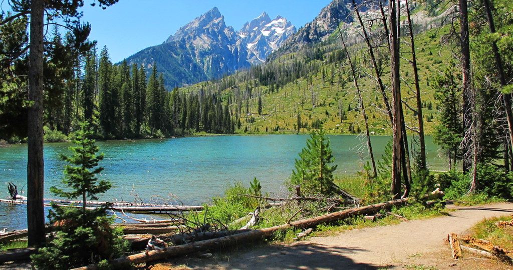
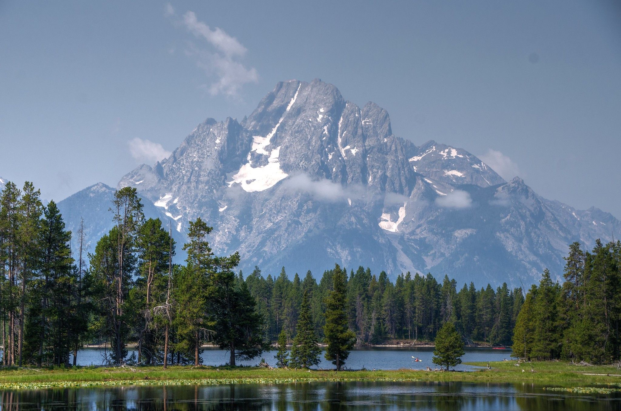
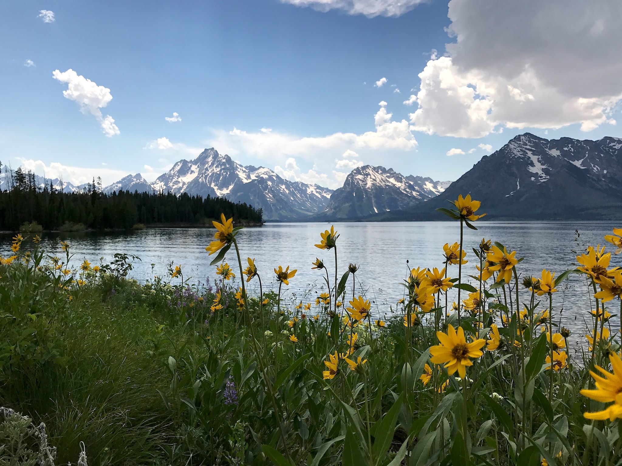
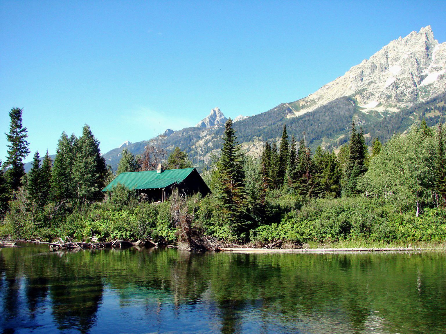
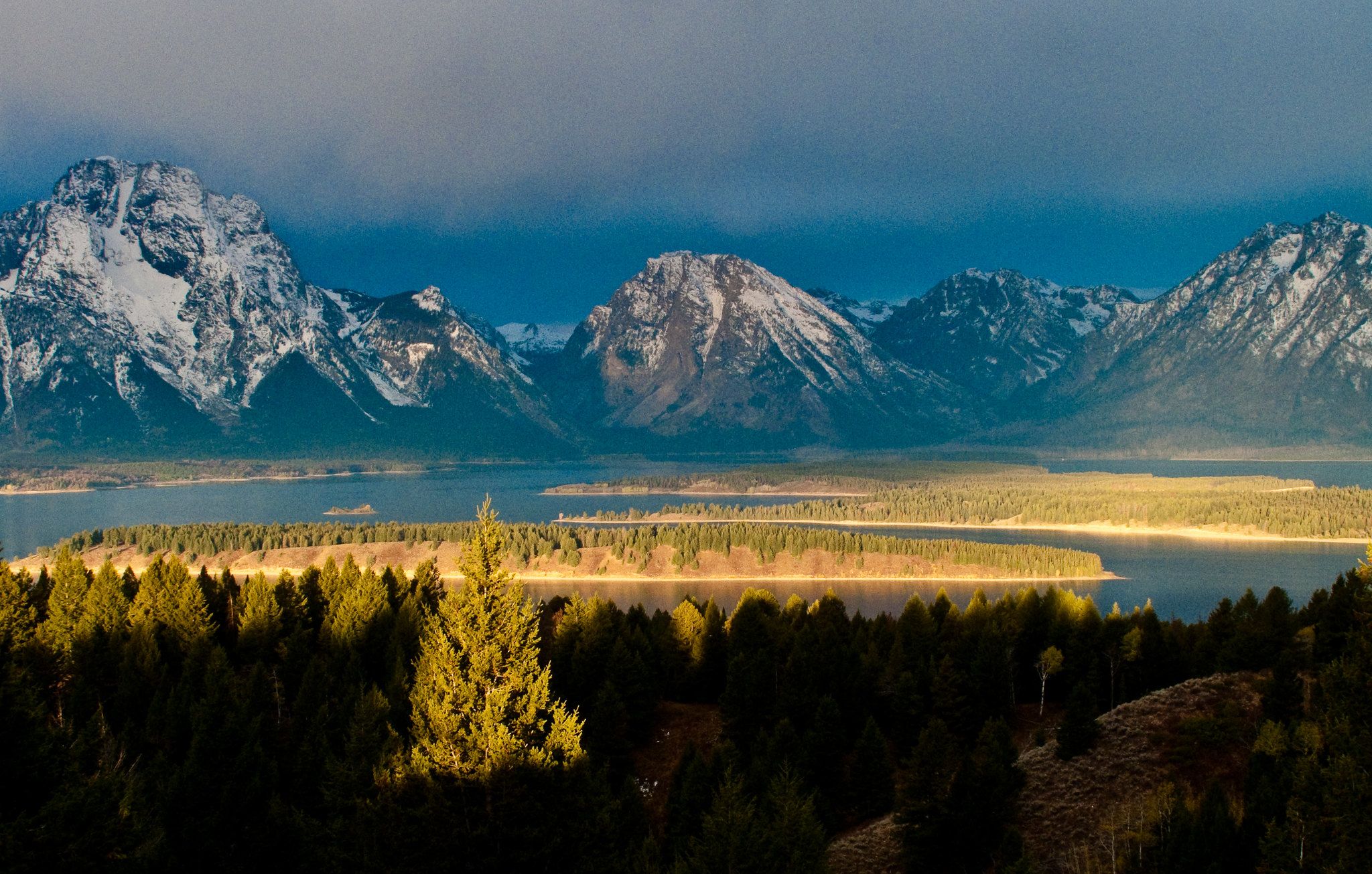
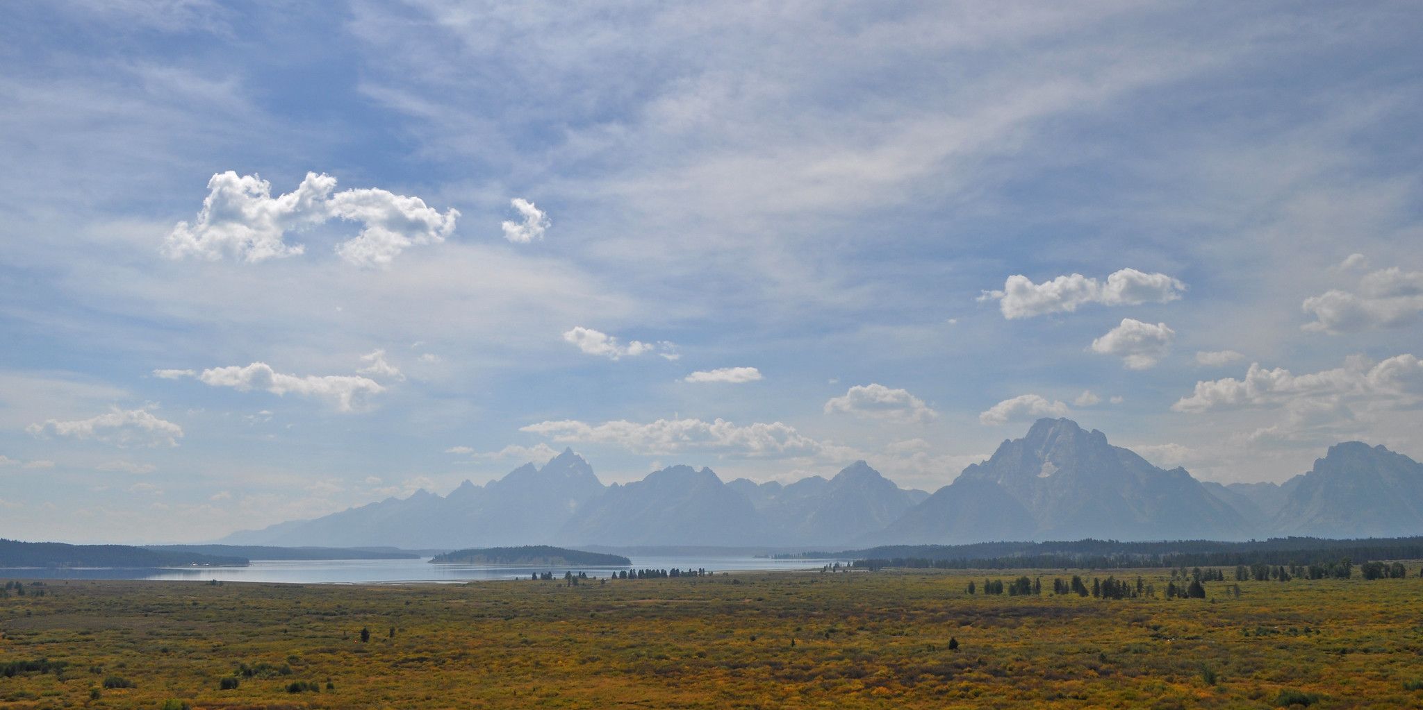
The Grand Teton National Park in Wyoming is a real hiking paradise with some of the most incredible landscapes in America. The park is dominated by the Teton Range, a spectacular stretch of mountains extending for over 40 miles long, covering 480 sq miles in total. You can enjoy views of the jagged peaks, as well as glacial lakes, wildflowers and a diverse array of wildlife.
There are an abundance of trails in the national park, from easy strolls to epic multi-day adventures, meaning there’s something for everyone.
Whether you’re planning a trip to the Grand Teton National Park or looking for some inspiration, here are the 14 best trails for every hiker.
Table of Contents
What you need to know about Grand Teton National Park
General information
- For hiking, the best time to visit Grand Teton National Park is in summer or fall, when the weather is warm, and you have a greater chance of clear skies.
- The entrance fee to the National Park is $35 per vehicle for seven days and $20 per hiker.
- Visitor centers in the park include Craig Thomas Discovery and Visitor Center in Moose, Jenny Lake Visitor Center and Colter Bay Visitor Center. You can pick up maps, enjoy the exhibitions and information on display and pick up souvenirs and books in the national park at these centers. Permits can also be issued at these visitor centers.
- If you plan on doing any multi day backpacking trips in the park you need to get a Backcountry Permit, this allows overnight hiking in the area. There is a limit on how many permits are issued per trail at a time so organize one ahead of time.
- The park is open 24 hours every day of the year, although some roads close in the winter months from December to April with heavy snowfall in much of the park.
Safety tips
- Always check the weather before hitting any of the trails in the Grand Teton National Park to ensure you’re properly prepared.
- Bears can pose a serious risk, especially in summer, so we recommend you carry bear spray with you which acts like a pepper spray for bears and is highly encouraged by park rangers.
- Carry a map or park guide book with you that outlines the trails you plan on hiking.
What to bring
- Ensure that you have packed all the essential items for hiking after considering the weather and safety.
- In Summer, the area can be hot with a strong sun, so be sure to carry sunscreen, sunglasses, a hat and SPF-rated lip balm with you.
- In Winter, snow blankets much of the park and it’s mostly reserved for skiers and snowshoers. Be prepared if you plan on hiking either side of winter as there may still be snow on some sections of the trails. This will mean you might need snowshoes, a warm down jacket and gloves.
- Always carry a rain jacket with you, as you never know when the weather may turn in the national park with frequent storms all year round.
- Bring plenty of snacks and carry enough water with you for the entirety of your hike. In summer, dehydration is a risk so ensure you have enough fluid in your backpack.
How to get there
Jackson Hole is the name of the valley that runs through the national park. The town of Jackson is at the southern end of it and acts as the main access point and base for people who are exploring the park.
There is a domestic airport in Jackson, and the nearest international airport is at Salt Lake City, around 270 miles away.
There is limited public transport access to the park. However, there are some long-distance Greyhound buses servicing Jackson from major cities such as Salt Lake City.
Hiring a car is the best option to get around the park, with limited bus networks operating in the area. Car hire is available at the domestic airport in Jackson.
If you plan on staying overnight in the national park, you can stay at one of the lodges or utilize the campgrounds. There are various campgrounds in the park suitable for RVs such as at Jenny Lake and Colter Bay. Otherwise, rustic cabins and hotel-style lodges can be found in the park. Popular choices include Jackson Lake Lodge, Jenny Lake Lodge and Colter Bay Village. They are usually open from May until October.
Easy day hikes
String Lake Loop
- Start/finish: String Lake Trailhead (43.784955380979916, -110.72782041864443)
- Distance: 3.7 miles loop
- Elevation gain: 300 feet
- Highlight: Walking around String Lake
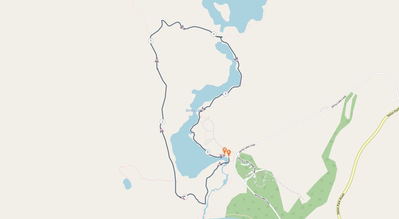 String Lake Loop is one of the easiest strolls in the park and is perfect for families. You can technically hike in either direction from the trailhead, although counter-clockwise is best in the mornings for stunning views of the mountains above the lake. Along the way you’ll be able to see the cathedral group of mountains (Teewinot, Grand Teton and Owen) as well as Mt Moran.
The parking lot and trailhead used for this loop hike is the same for Leigh Lake and Paintbrush Canyon Trails. It fills quickly on weekends, so arrive early if you want to get a decent car spot.
Hermitage Point Trail
- Start/finish: Hermitage Point Trailhead (43.900682352149836, -110.64216408698825)
- Distance: 10 miles
- Elevation gain: 380 feet
- Highlight: Walking around Jackson Lake
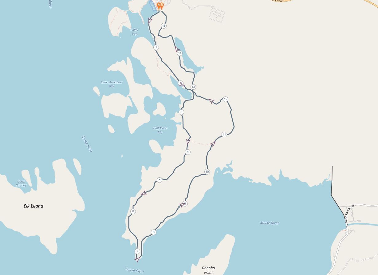
Don’t let the distance of this hike deter you, this 10-mile trail through the wetlands and forests of Jackson Lake is relatively flat and scenic for most of the way. The trail begins near the Colter Bay visitor center and campground, making it easily accessible.
The wetlands around the lake are a real wildlife haven which makes it a great option for a long day hike for families. It usually takes around 5 hours to complete.
Colter Bay Lakeshore Trail
- Start/finish: Lakeshore Trailhead (43.90585867401086, -110.64648345519274)
- Distance: 2 miles roundtrip
- Elevation gain: 100 feet
- Highlight: Views of Jackson Lake and the Teton Range
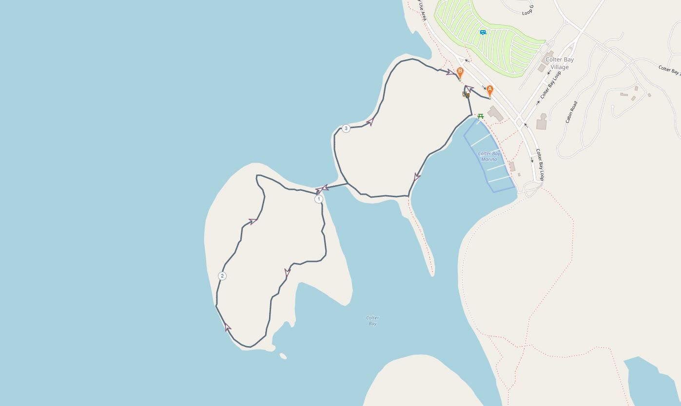 This easy trail follows Colter Bay shoreline from the Colter Bay visitor center. It’s a short trail which is a great introductory hike that can be done in just an hour. You can get great views of Jackson Lake and the Teton Range for those short on time.
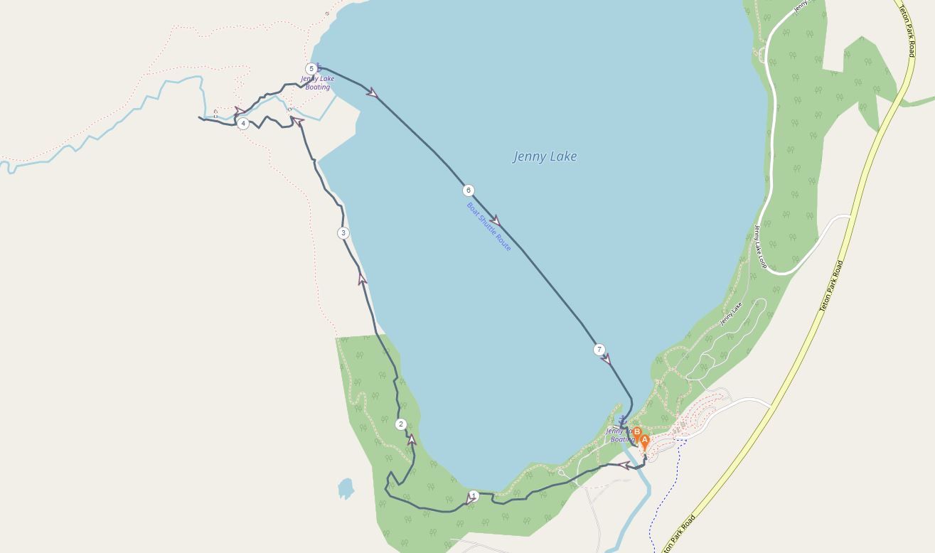
Jenny Lake Loop
- Start/finish: Jenny Lake Trailhead (43.75186764893982, -110.72546442865601)
- Distance: 7.2 miles
- Elevation gain: 500 feet
- Highlight: Circumnavigating Jenny Lake
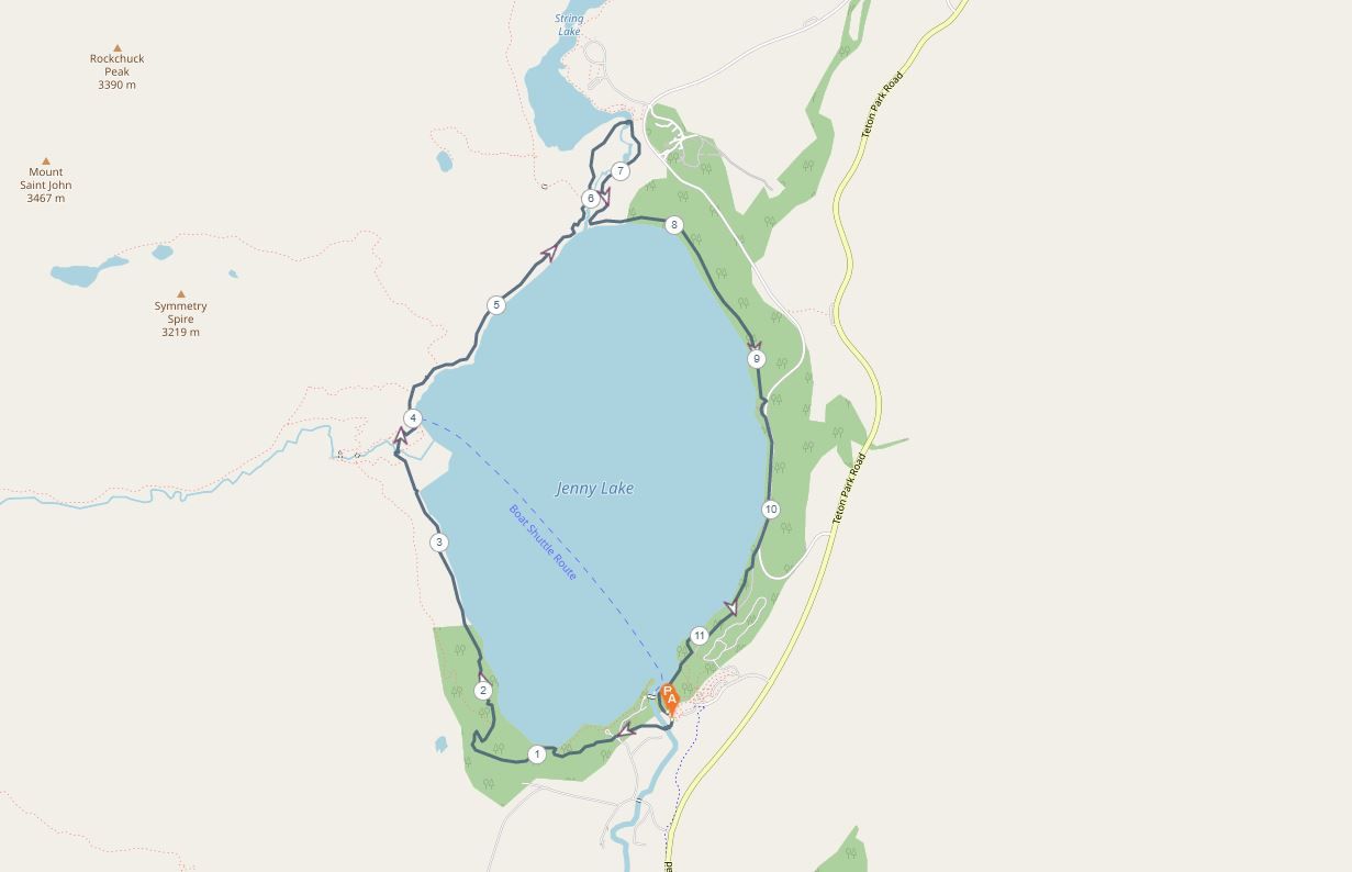 Jenny Lake Loop is a moderately gentle trail that skirts the shoreline of Jenny Lake. The trail begins at the Jenny Lake visitor center and campground along Teton Park Road. It’s one of the more popular day hikes in the Grand Teton National Park with great views of the soaring peaks for most of the way.
Around halfway around the trail you’ll find the West Shore Boat Dock where the lake ferry transports hikers who plan on tackling Inspiration Point, Cascade Canyon and Lake Solitude. These are more challenging extensions to the Jenny Lake trail.
Medium hikes
Inspiration Point
Start/finish: Jenny Lake Trail or West Shore Boat Dock (43.76738378834339, -110.74408553194931)
- Distance: 2.2 miles return
- Elevation gain: 450 feet
- Highlight: Views overlooking Jenny Lake
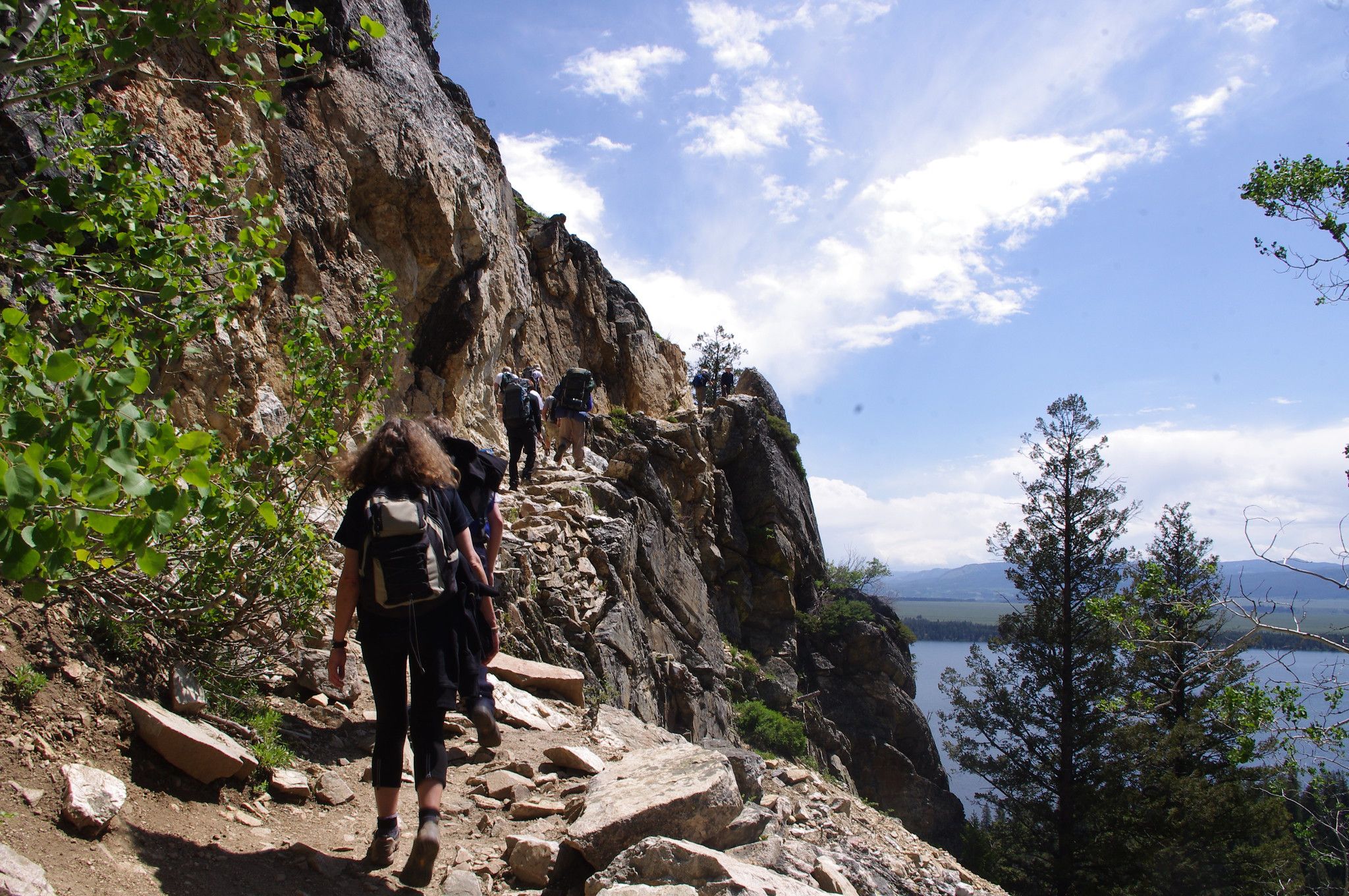
 Inspiration Point is a side trail off the Jenny Lake Loop and a fantastic viewpoint over the alpine lake. The trail can be reached either directly off the lake loop trail or via a shuttle ferry which stops at the West Shore Boat Dock. From the dock, which is halfway around the lake loop, the hike is a 2.2 mile return climb up to the viewpoint.
The trail diverts from the main path and heads towards Cascade Canyon. It’s a great addition to the Jenny Lake Loop for added views.
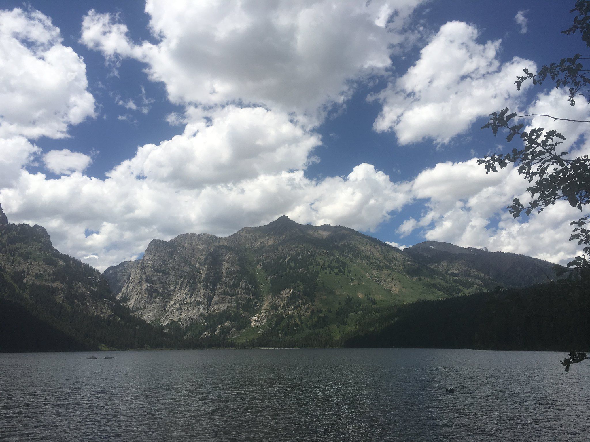
Phelps Lake Loop
- Start/finish: Death Canyon Trailhead (43.657151196340315, -110.78093144473567)
- Distance: 6.3 miles
- Elevation gain: 600 feet
- Highlight: Fantastic Teton view
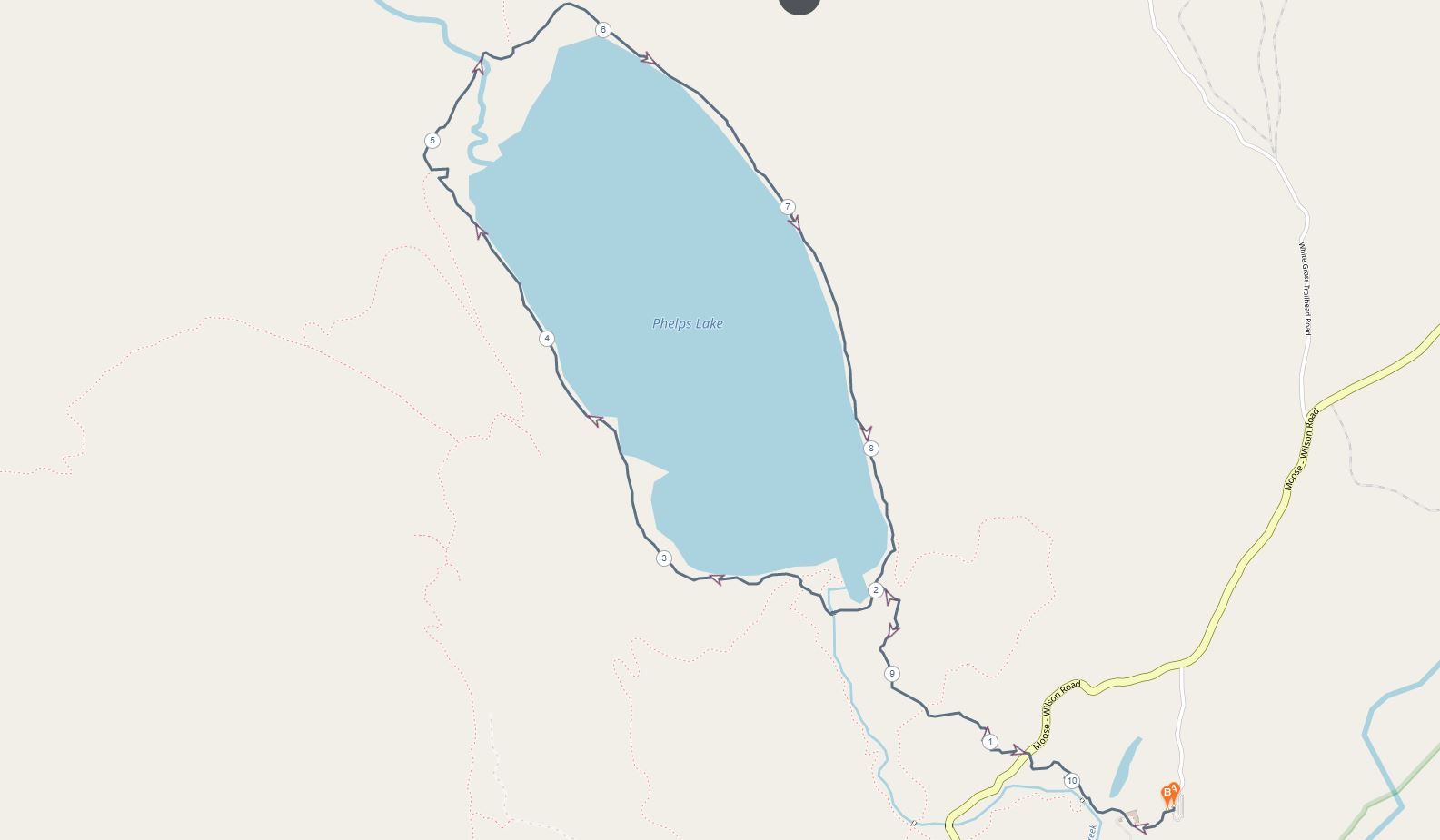 This loop is an easy-moderate trail around one of the many lakes in the Jackson Hole valley. The trail is in the Laurance S. Rockefeller Preserve and begins from the White Grass Ranger Station. It’s a very popular day hike with a high potential to see some great wildlife as the trail navigates the shoreline of the glacial lake.
Although not technically overly difficult, there are some steep sections that require a moderate level of fitness. When the lake is still, you’ll enjoy a perfect reflection of the Tetons in the water.
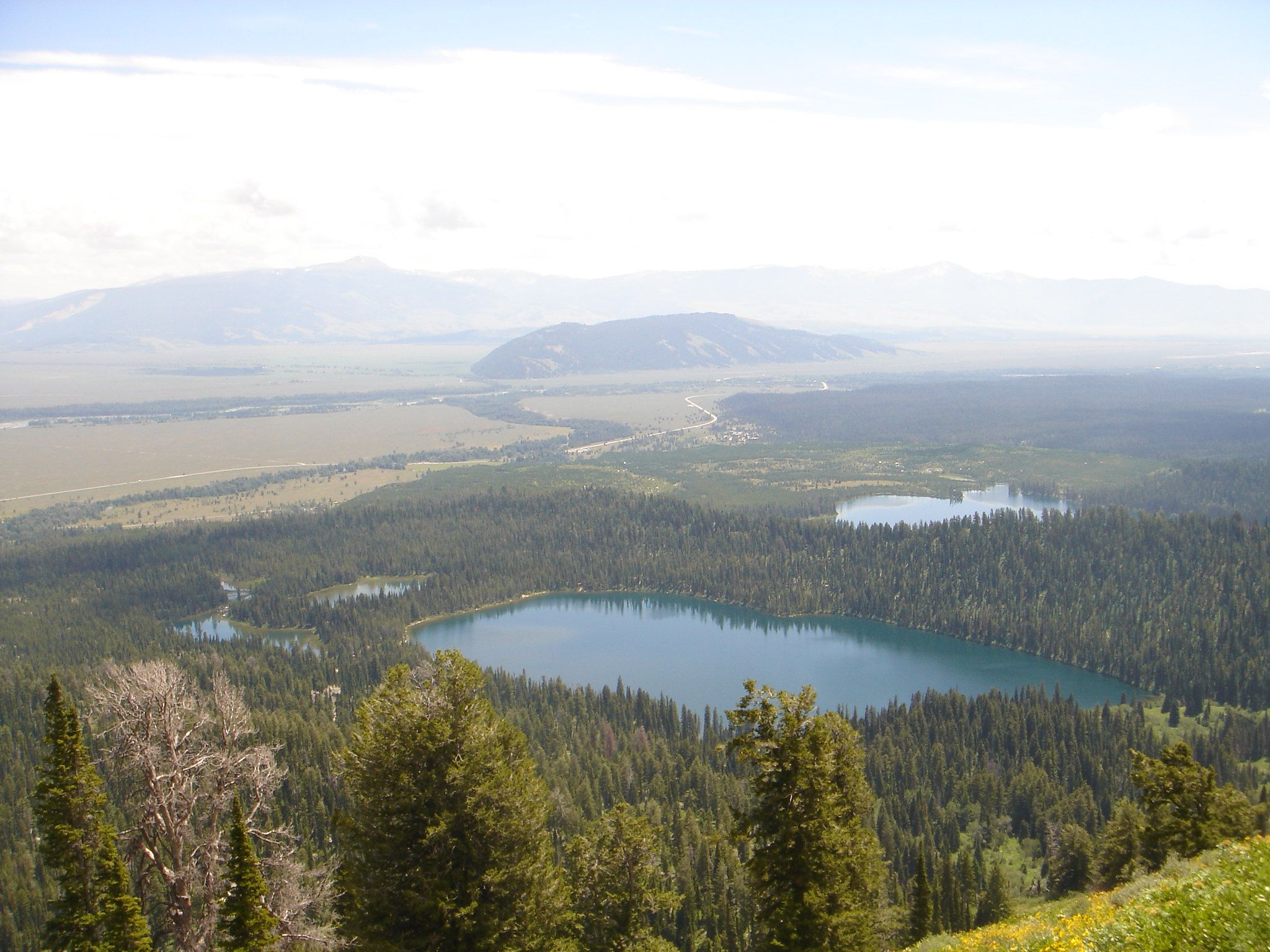
Signal Mountain
- Start/finish: Signal Mountain Lodge and campground area (43.84075188096826, -110.61097111898681)
- Distance: 6.8 mile loop
- Elevation gain: 850 feet
- Highlight: Panoramic views of the Teton Range
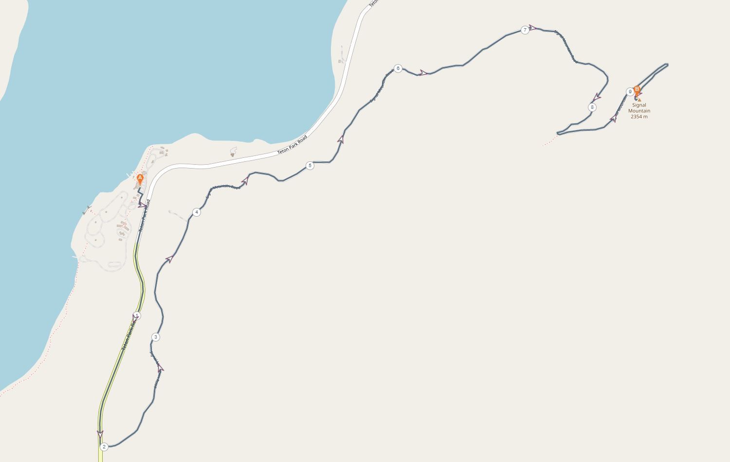 Signal Mountain is a mildly difficult hike with great mountain views. The trail starts near the Signal Mountain Lodge and camping area on Teton Park Road outside of Moran. The trail has a moderate ascent but the views are some of the most astounding you can get from a day hike in Grand Teton National Park.
At the summit, you’ll find an incredible panorama of the Teton Range across the skyline which offers one of the best opportunities to fully grasp the scale of this beautiful national park.
Death Canyon Trail to Static Peak Junction
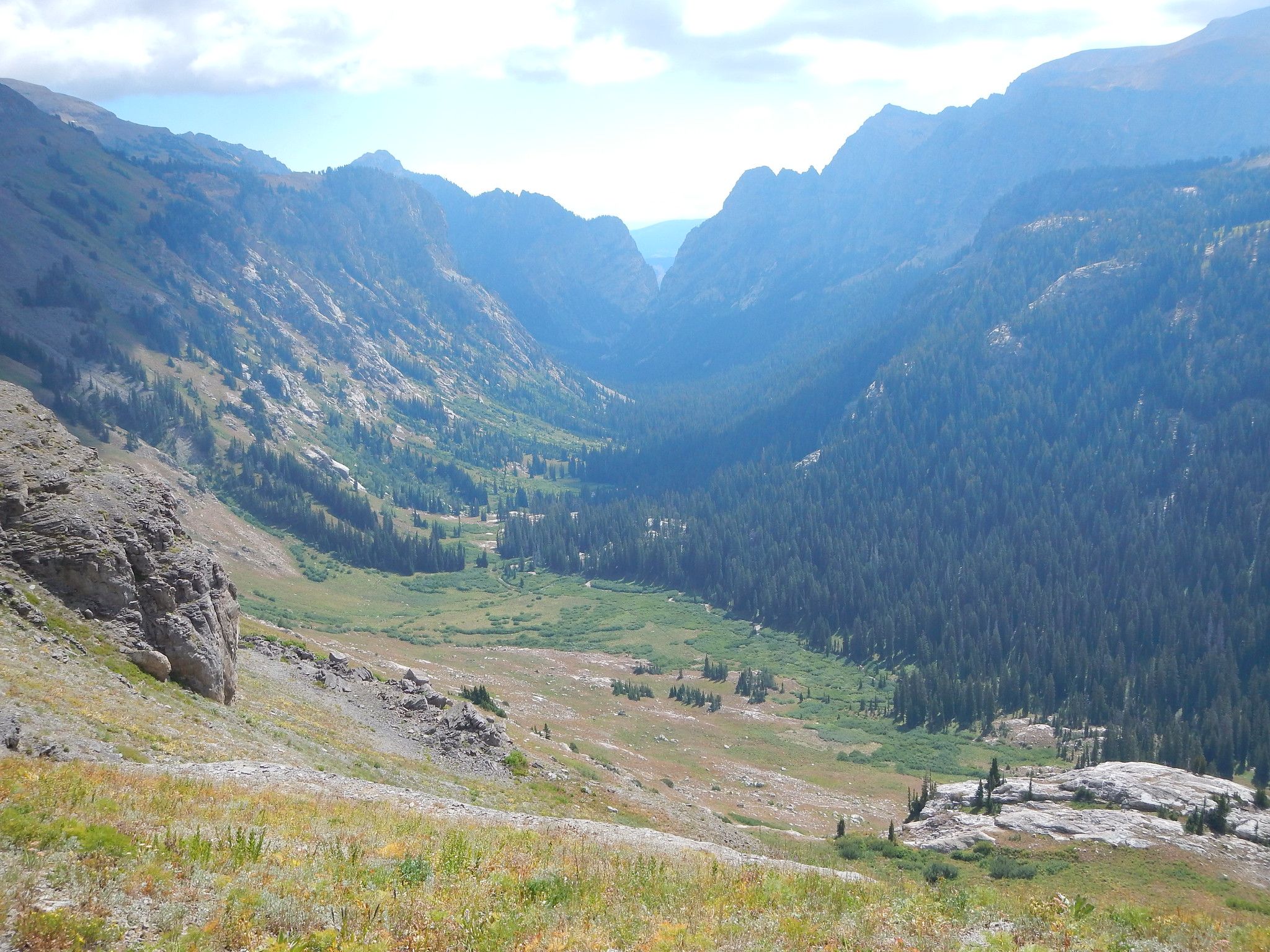
- Start/finish: Death Canyon Trailhead (43.657151196340315, -110.78093144473567)
- Distance: 8 miles return
- Elevation gain: 2000 feet
- Highlight: Close up views of jagged peaks
 Death Canyon Trail is a moderate to difficult hike that can be tailored to suit your own time limits and fitness levels. The trail begins near the White Grass Ranger Station and first climbs to an overlook of Phelps Lake. From there you continue through Death Canyon with a steady elevation gain that will make your legs burn.
Once you reach Static Peak Junction at the four-mile point of the hike, most people turn back to the trailhead. However, if you’re fit and have plenty of time, you can continue on to Static Peak Divide, a further 3.8 miles onwards. Either way, you’ll get incredible views through Death Canyon of the rugged peaks with seasonal wild flowers surrounding the trail.
Forks of Cascade Canyon
- Start/finish: Jenny Lake Trail or West Shore Boat Dock (43.76738378834339, -110.74408553194931)
- Distance: 9.7-miles
- Elevation gain: 1500 feet
- Highlight: Panoramic lake views
 This trail to the forks of Cascade Canyon is one of the most picturesque and popular of the day hikes in the Jenny Lake area. It requires a more solid fitness base than the Jenny Lake Loop or Inspiration Point, but the views are a worthy reward.
This hike would be 3.5 miles longer if you begin at the Jenny Lake Loop trailhead, but it’s more common to start at the boat dock after a short ferry ride.
The trail turns off the Jenny Lake Loop trail at the West Shore Boat Dock and heads up through Cascade Canyon. You’ll pass Inspiration Point and Hidden Falls and continue up to the fork junction in the canyon that offers incredible views back through the rocky walls and across the Teton peaks.
From this junction, most people turn around, however, it’s possible to continue on to Lake Solitude which makes into a challenging day.
Challenging hikes
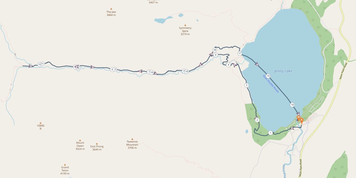
Lake Solitude
- Start/finish: Jenny Lake Trail or West Shore Boat Dock (43.76738378834339, -110.74408553194931)
- Distance: 14 miles return
- Elevation gain: 2300 feet
- Highlight: Panoramic views of the Tetons
 This is a challenging day hike that is worth all the effort. The first part of this hike is the same as the Forks of Cascade Canyon, which takes you from the shores of Jenny Lake up to a junction. From there, you need to take the right path or otherwise known as North Fork of Cascade Canyon towards the alpine lake of Solitude.
After a steady climb, the views from the lake make it all worthwhile. The incredible panoramic views of the Tetons will stretch right around you and you can take a dip in the cool water of Lake Solitude if you’re up for it.
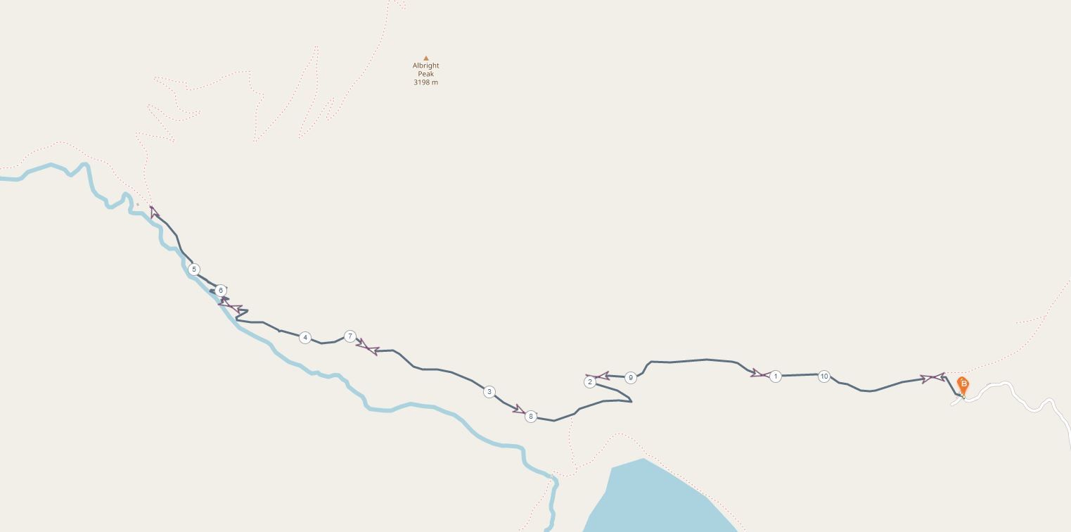
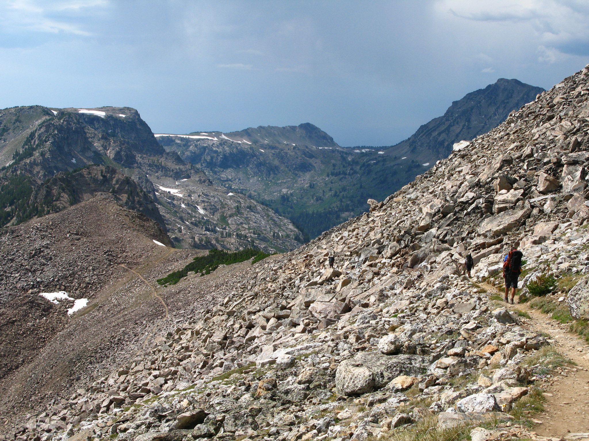
Garnet Canyon
- Start/finish: Lupine Meadows Trailhead (43.734845598166714, -110.74156430225734)
- Distance: 9.5 mile return to the Meadows
- Elevation gain: 2500 feet
- Highlight: Views of Middle Teton
 For it’s short distance this day hike packs a lot of punch. It starts and follows the same trail as the more popular Amphitheatre Lake hike, however, after three miles you need to turn off and climb through the Garnet Canyon. The trail is very steep with plenty of switchbacks cut into the slopes of the rocky walls.
After four miles of hiking, you’ll come to what is referred to as the Boulder Field with breathtaking views of Middle Teton, Nez Perce and the canyon you’ve just come through. For those wanting a more challenging addition, you can navigate the boulders for another mile until you reach the Meadows, a popular camping area for rock climbers.
Surprise and Amphitheatre Lake
- Start/finish: Lupine Meadows Trailhead (43.734845598166714, -110.74156430225734)
- Distance: 10 miles round trip
- Elevation gain: 3000 feet
- Highlight: Mountain views from lake shores
 This difficult day hike in the Grand Teton National Park is one of the best and most popular. It’s a steep elevation gain and is only recommended for fit hikers, but the effort is rewarding with stunning lake views.
The trail is a steady ascent between Glacier Gorge and Garnet Canyon. At the top, you’ll find yourself at two alpine lakes beneath the dramatic Disappointment Peak with the views extending back towards Middle Teton, Grand Teton and Mount Owen.
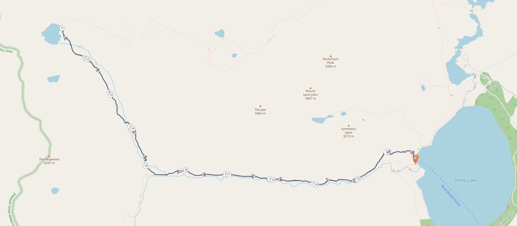
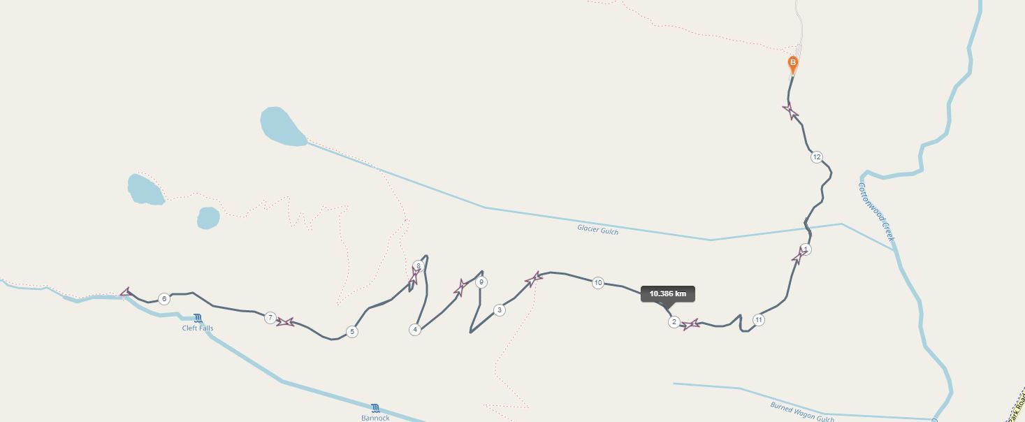
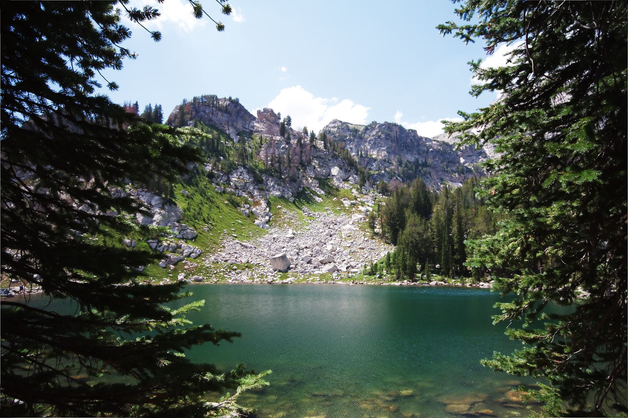
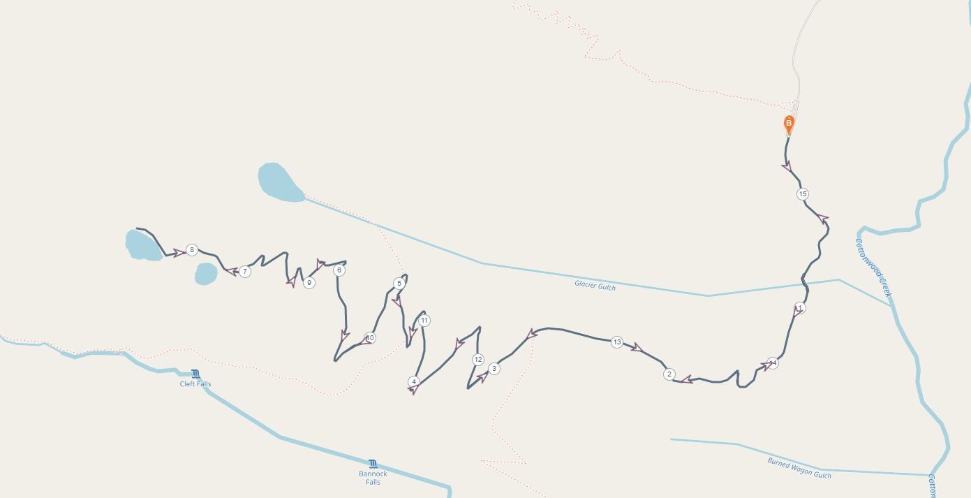
Granite Canyon-Marion Lake
- Start/finish: Granite Canyon Trailhead (43.60790534777744, -110.79251259002066)
- Distance: 18 miles return
- Elevation gain: 3000 feet
- Highlight: Marion Lake, a spectacular alpine lake
 Granite Canyon is the southernmost canyon that has accessible trails in the Grand Teton National Park. The hike up to Marion Lake is no walk in the park and should be reserved for fit and experienced hikers. The 18-mile trail climbs over 3000 feet from the trailhead to Marion Lake, a spectacular alpine lake surrounded by jagged peaks.
It’s possible to complete in a day, however, you have to leave early and understand that it’s a long strenuous climb. If you have time, Granite Canyon is more enjoyable as an overnight hike. If you plan on camping then ensure you get a permit from the National Park Service before heading out.
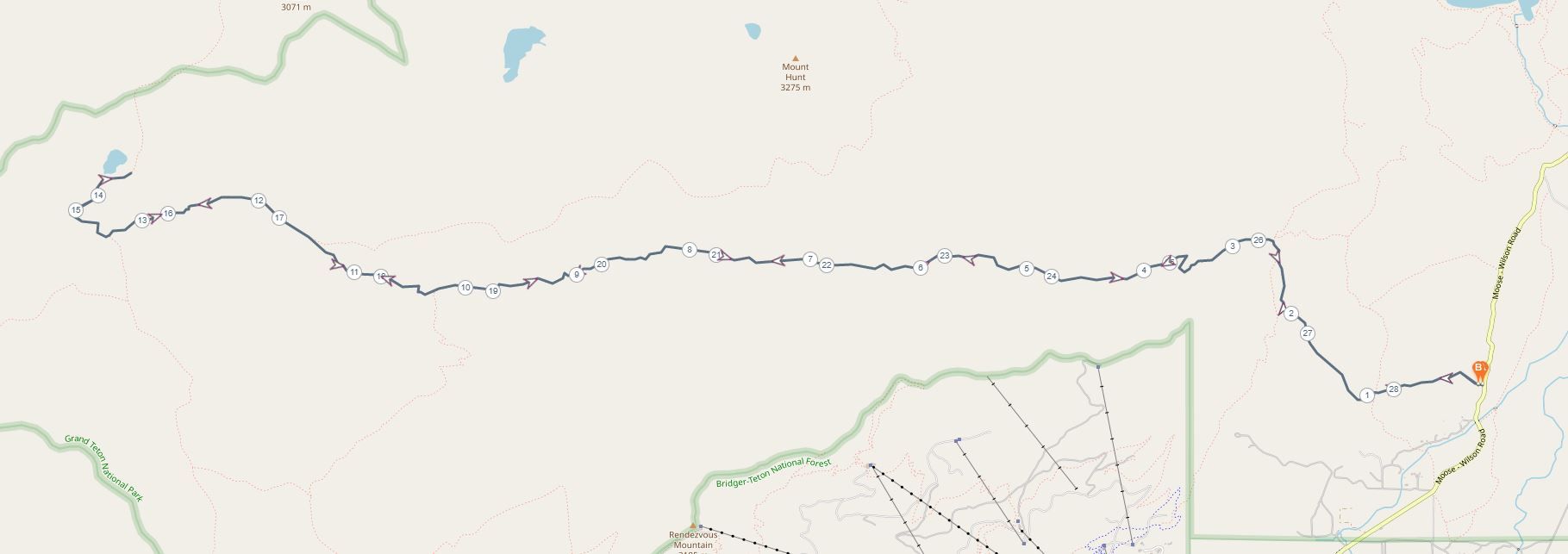
Teton Crest Loop
- Start/finish: Teton Village (43.584926, -110.825106) and finishes at Jenny lake Trailhead (43.75193594847318, -110.72543648648144)
- Distance: 48 miles
- Elevation gain: 9300 feet over 48 miles
- Highlight: Covers most of the park’s highlights
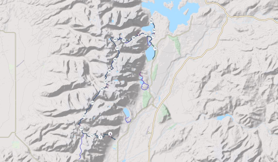 This is one of America’s great bucket list trails. The 50-mile hike takes you through the heart of the Grand Teton National Park and is the park’s biggest adventure. You need a permit to hike this trail with a comprehensive plan to submit to park rangers outlining your itinerary. It’s best to arrange this far in advance with very limited permits available.
The trail takes in the alpine lakes, high altitude passes and spectacular mountain panoramas across the park and is the best way to completely appreciate the raw beauty of the Tetons. It generally takes around five days to complete the circuit, with around eleven permitted camping areas along the way.