
Santa Barbara has some of the most scenic day hikes in California. The city is wedged between the rugged Santa Ynez Mountain Range and the Pacific coastline making for incredibly stunning landscapes and panoramic views.
The beautiful mountains and canyons at the backdrop of the city have countless trails that are popular with both hikers and mountain bikers. From steep, challenging climbs leading to exposed peaks to more gentle walks through forest and wildflowers, Santa Barbara has plenty of trails for any level of experience and fitness.
Scenic coastal views are the real highlight of most hikes but the proximity to unique flora and fauna also makes Santa Barbara a great destination for all outdoor lovers.
Here are the most popular and interesting day hikes around Santa Barbara.
Table of Contents
What you need to know about hiking in Santa Barbara
- Mountain biking is popular on some of these trails, which means hikers and riders have to share the same paths. Be alert to riders flying down the hills and try to keep to one side of the trail.
- Some of these trails are heavily exposed once you climb above the treeline, this means that you need to be prepared to be sun smart. Carry sunscreen, SPF lip balm, a hat and sunglasses with you.
- Many hikes in the Los Padres National Forest mentioned below require an Adventure Pass purchased from the Forest Service. This needs to be displayed in your vehicle. There are daily passes for $5 and yearly passes for $30 available. You can find out more here.
- There is also an entry ticket required for Botanic Gardens, which charges around $16 for entry per adult.
- On hot summer days keep an eye on the trail for snakes. Santa Barbara has venomous snakes including rattlesnakes, although sightings of these are rare, you should be aware of where you’re stepping on the trail.
- Poison oak is rampant throughout the Santa Barbara area and you need to be able to recognize its green leaves so you can avoid it. It can pose a serious threat to those who are allergic to it.
- Most trails in Santa Barbara are well maintained with signposts but take a GPS or map if you’re concerned about navigation.
- Masks are required indoors in Santa Barbara, but not outdoors and while hiking. There are no COVID restrictions for outdoor activity in California.
1. Inspiration Point Trail

- Start/finish: Inspiration Point Trailhead, Tunnel Road (34.46526121187696, -119.71253610259119)
- Distance: 3.75-mile return from Tunnel Road
- Elevation gain: 800 feet
- Difficulty: Moderate
- Trail Map: Download
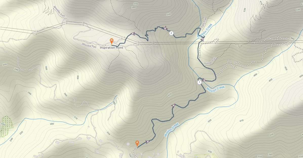
Inspiration Point is one of the most popular day hikes in Santa Barbara. The aim is to reach the aptly named summit at 1800 feet which offers stunning views over the city skyline to the Channel Islands and back to the Santa Ynez Mountains.
There are two options with this hike. The shorter and more popular option is to start at what is referred to as Inspiration Point Trailhead on Tunnel Road. From there, take the Tunnel Trail until you reach the intersection with the Jesusita Trail. You then turn left onto this trail which takes you to the summit and popular lookout.
A longer and more scenic option is to start at San Roque Road on the other side of the range. From there, take the Jesusita Trail up to Inspiration Point and back, which is an 8-mile round trip. This day hike offers more ocean views on the ascent but requires much more of your time and effort to complete.
Most people take the 3.75-mile option via Tunnel Trail and do it in the late afternoon with the golden sun offering the best photo conditions.
2. Seven Falls Trail

- Start/finish: Inspiration Point Trailhead, Tunnel Road (34.46526121187696, -119.71253610259119)
- Distance: 3.2-mile return
- Elevation gain: 800-feet
- Difficulty: Easy
- Trail Map: Download
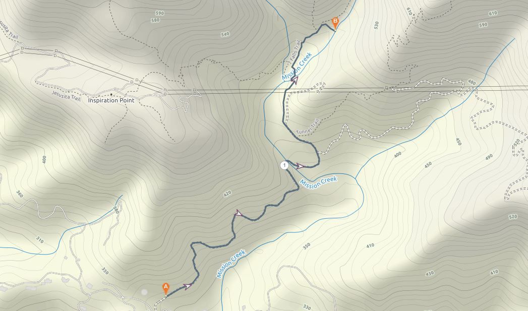
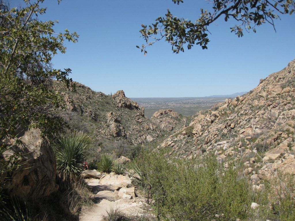
The Seven Falls hike is one of the most fun trails of the area. The hike starts at the same trailhead as Inspiration Point and follows the same trail at first. However, at the intersection, instead of turning onto the Jesusita Trail which takes you up to the lookout, you need to keep going and follow Mission Creek upstream towards the falls.
The hike requires a bit of rock hopping or wading through water after heavy rains, which makes it a fun and exciting trail. When you come to the falls, you’ll find several stone basins cascading down the valley. After spring rainfall, these become deep natural swimming holes, so don’t forget to bring your swimsuit.
It’s the best hike to enjoy on a hot summer’s day.
3. Jesusita Trail
- Start/finish: Jesusita Trailhead, San Roque Road (34.4546213358196, -119.72881948909694)
- Distance: 4.5-mile point to point
- Elevation gain: 1200 feet
- Difficulty: Moderate
- Trail Map: Download
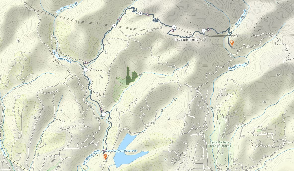
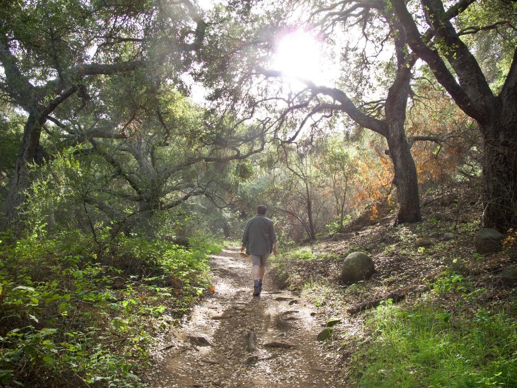
The Jesusita Trail is a great hike to take in all the stunning views across the mountain range immediately above Santa Barbara. The hike starts at the Jesusita Trailhead off San Roque Road. It takes you up through the San Roque Canyon and crosses over the creek multiple times as you follow the marked trail.
Once you hit the top of the ridge, the dirt track continues until you reach Inspiration Point, a popular lookout. Once you’ve taken in the beautiful views over the ocean and city below, the trail continues down the backside of the mountain until it meets up with the Tunnel Trail.
This is a point to point hike rather than a loop. You’ll need to either hike back the same way to your car or arrange a pick up from Tunnel Road.
4. Romero Canyon Trail
- Start/finish: Romero Canyon Trailhead, off Bella Vista Drive (34.45312191068262, -119.59060726660238)
- Distance: 5.3-mile loop
- Elevation gain: 2000-feet
- Difficulty: Moderate
- Trail Map: Download
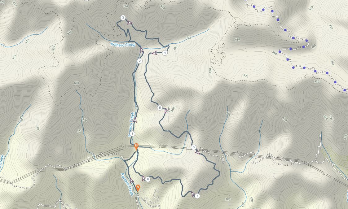
The Romero Canyon trail is popular with both hikers and mountain bikers, although it sees far less traffic than some of the others closer to downtown Santa Barbara.
The Romero trail is one of the few loop hikes in the area, meaning you can have a more varied return to the start point. It’s a relatively challenging long day hike but is incredibly rewarding.
The trail starts just off Bella Vista Drive and winds its way through the shady canyon following Romero Creek. Eventually, the trail crosses over old Romero Road and continues steeply up to the top of the Santa Ynez Range. If you take the side trail to the left, you’ll make it to the top of Romero Saddle, where you’ll enjoy one of the best views in the city stretching right across the ocean to the Channel Islands.
From there you can follow the dirt Romero Canyon Road back down rather than following the same trail.
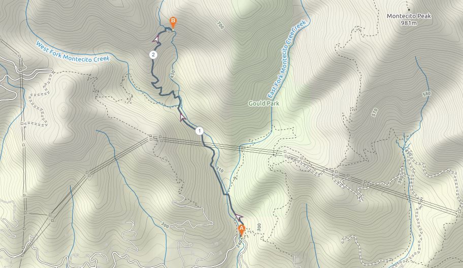
5. Montecito Peak Trail
- Start/finish: Cold Spring Trailhead, off East Mountain Drive (34.45615722929656, -119.6528716102533)
- Distance: 7-mile return
- Elevation gain: 2450-feet
- Difficulty: Moderate
- Trail Map: Download
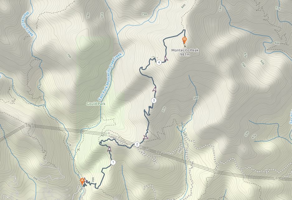
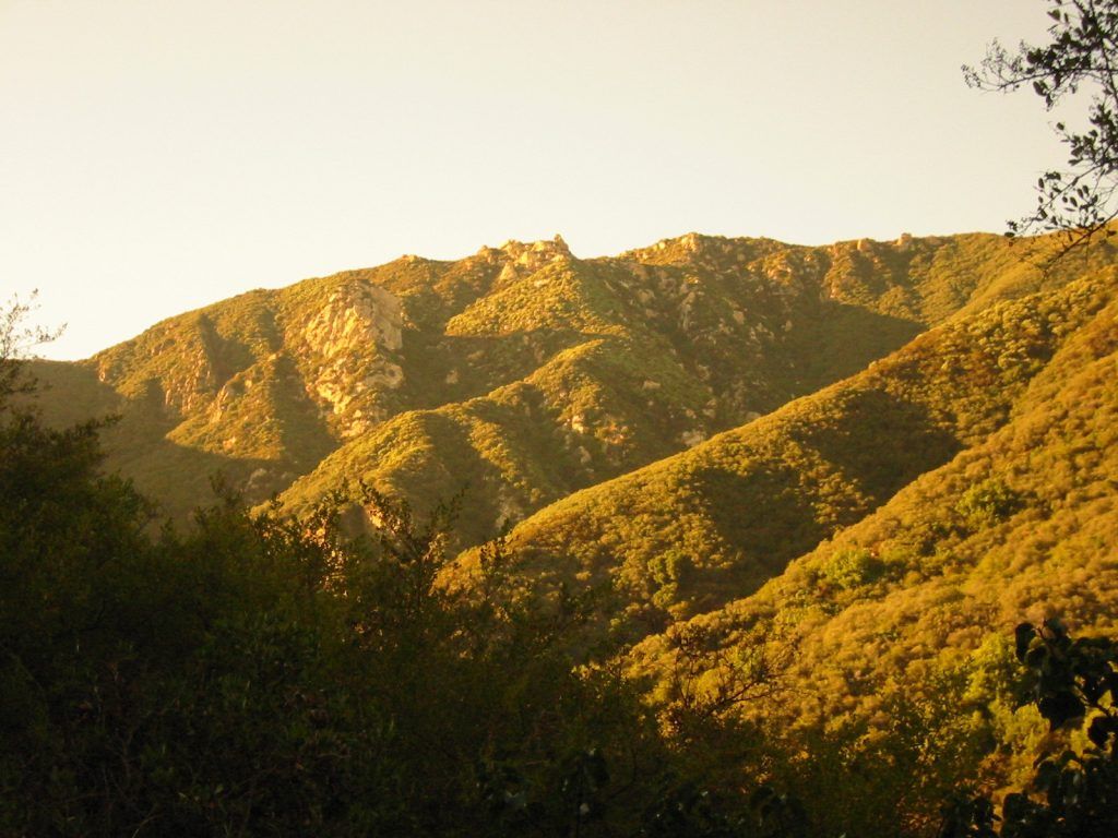
Montecito Peak is one of the highest points of the Santa Ynez Range. If you’re after epic views and a challenging climb, then this Santa Barbara hike is perfect for you. The views along the whole trail are worthwhile, but the 360-degree vista of the Pacific coast from the summit is the absolute highlight.
The trail starts at the Cold Spring Trailhead, off East Mountain Drive in Montecito. You’ll follow the trail on the east bank of the Cold Springs Creek through the Los Padres National Forest. As you climb higher the vegetation starts to thin and you’ll be more exposed as the views start to reveal themselves.
When you finally reach the top of the peak, the view stretches right down the coastline and out across to Channel Islands.
6. Rattlesnake Canyon Trail
- Start/finish: Rattlesnake Canyon Trailhead, off Las Canoas Road (34.45781489256426, -119.69226688886961)
- Distance: 5-mile return
- Elevation gain: 800-feet
- Difficulty: Easy/Medium
- Trail Map: Download
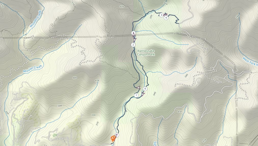
Rattlesnake Canyon is not as frightening as it sounds. It’s a relatively easy return hike that is much less crowded than Inspiration Point and Seven Falls in the adjacent canyon.
The trailhead is at the top end of Skofield Park and is marked by a large sign. The gentle trail follows a creek through beautiful forest and wildflowers. You can return the same way you came to make it a shorter 3.5-mile hike.
However, it’s worth taking the turnoff onto the trail that reaches further up the canyon to Gibraltar Road where you can get a beautiful ocean view. If you include this side trip then it becomes a longer but worthwhile 5-mile return hike.
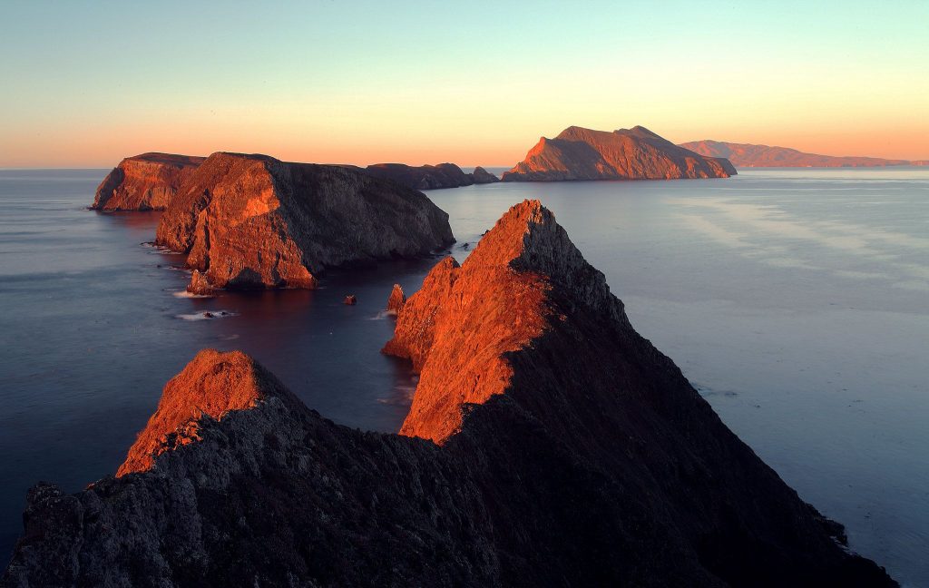
7. Channel Islands National Park
- Distance: Varies
- Difficulty: Medium
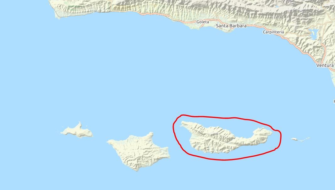
The five islands that make up the Channel Islands National Park have countless hiking trails. While the islands are not far off the mainland, you’ll find a completely different experience with unique flora and fauna and raw beauty.
The islands each have their own look and feel, from Anacapa Island’s flatter and well-maintained trails to the more rugged and unsigned paths of Santa Rosa Island.
You can take a local boat across to Santa Cruz island daily or Anacapa on five days of the week. These are the two most popular islands to visit and the boat ride is just an hour from the mainland. From there, you can navigate your own way around the small islands on marked trails.
Reaching the other islands usually requires a private chartered boat.
8. Tangerine Falls Trail
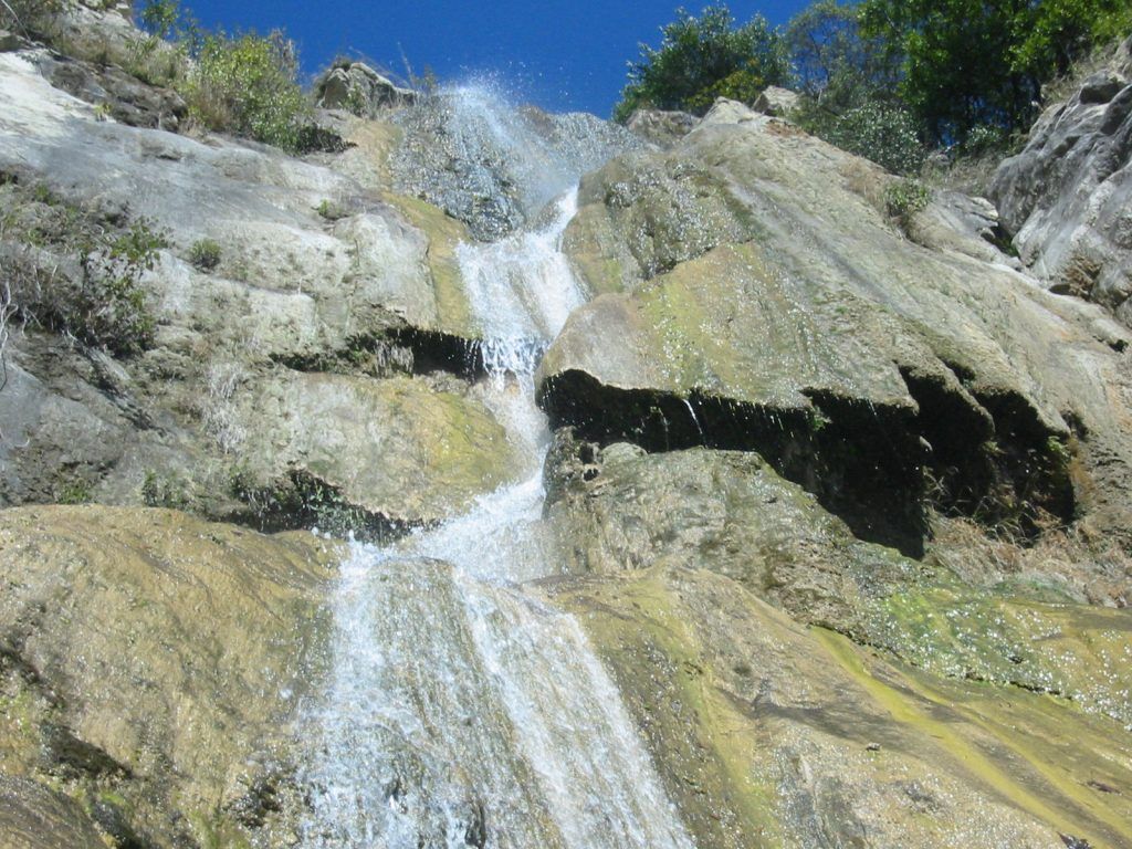
- Start/finish: Tangerine Falls Trailhead, off East Mountain Drive (34.45616102160289, -119.65328709877046)
- Distance: 2.5-mile return
- Elevation gain: 875-feet
- Difficulty: Medium
- Trail Map: Download
The 100-foot Tangerine Falls is one of the most beautiful waterfalls in Santa Barbara. The spectacular seasonal falls make for a great place to hike through the West Fork Cold Spring Canyon in the Los Padres National Forest.
The trail starts just left of the trailhead for the Montecito Peak climb. It winds its way through a shady canyon while rock hopping over the creek. You’ll pass several short cascades and the final climb over exposed boulders will take you to the bottom of the flowing Tangerine Falls.
The falls are seasonal and it’s best to visit them just after the peak spring rains, otherwise it can be just a trickle in summer.
9. Cathedral Peak Trail
- Start/finish: Inspiration Point Trailhead, Tunnel Road (34.46526121187696, -119.71253610259119)
- Distance: 4-mile return
- Elevation gain: 2400 feet
- Difficulty: Hard
- Trail Map: Download
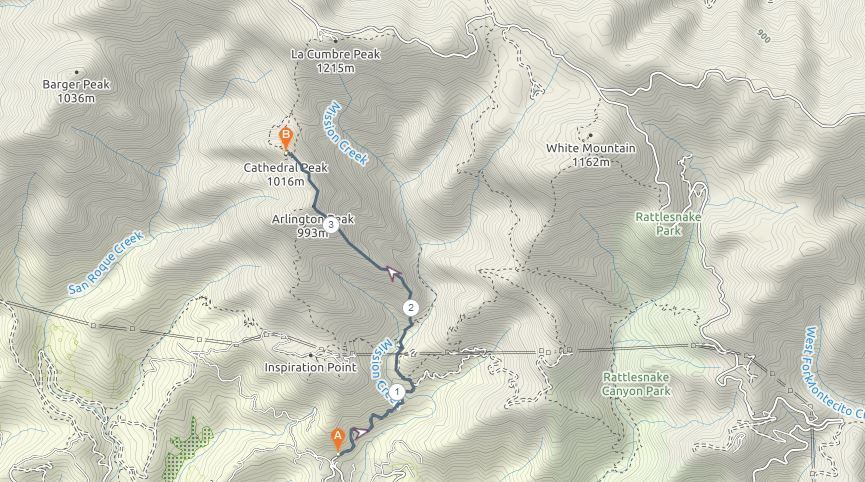
Cathedral Peak is one of the most challenging day hikes in Santa Barbara. It’s a strenuous four-mile return trail that gains over 2000-feet and requires climbing over boulders and navigating difficult terrain.
For all the hard work, it’s one of the most rewarding hikes with wondrous views over the Santa Ynez Range. The hike begins at the same trailhead as Inspiration Point and Seven Falls. However, instead of turning left at the junction to the Jesusita Trail, you need to take the trail to the right that goes directly up towards the rugged peak.
Once you reach the spectacular viewpoint, there’s even a more challenging option. For the fit and daring, you can continue on to La Cumbre Peak, which is further up along an undefined route.
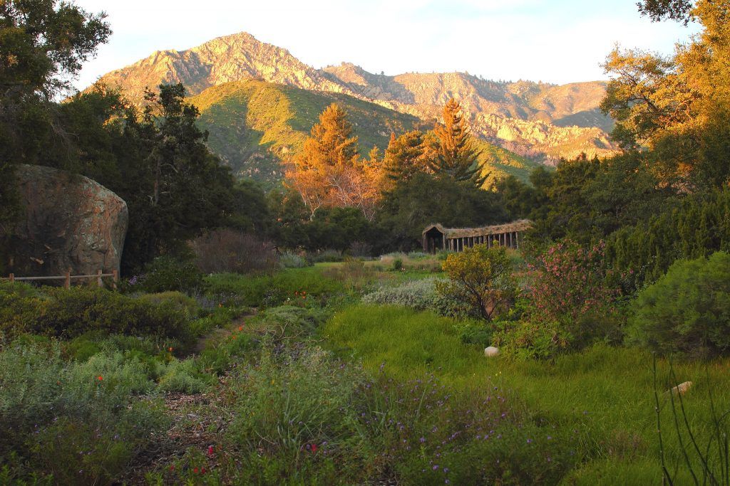
10. Santa Barbara Botanic Garden Trail
- Start/finish: Mission Canyon Road
- Distance: More than 5-miles of trails
- Difficulty: Easy
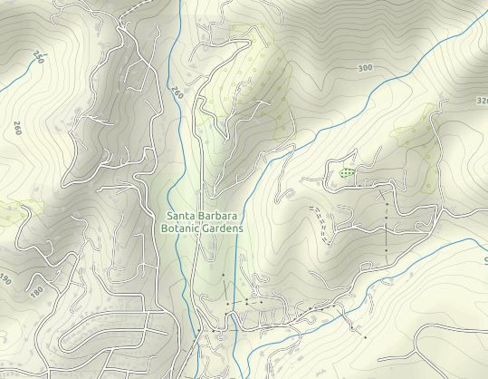
The Santa Barbara Botanic Garden is a 78-acre nature reserve with more than 1000 rare and native plant species. It’s one of the best places in the city to slip into the natural beauty of the area with over 5-miles of trails through redwoods and meadows.
The most popular trail is the Porter Trail which offers the best views in the garden. Besides nature, you’ll also find an authentic Japanese Teahouse and Garden as well as the historic Mission Dam which was built in 1807.
The Gardens have an admission fee of $16 for adults and are only open from 9 am to 5 pm daily.
Conclusion
Santa Barbara is one of the best cities in California for hikers. The beautiful location on the Pacific coast with the backdrop of the Santa Ynez Range means the views from most of the trails are incredibly striking. From challenging climbs to easier forest walks, Santa Barbara offers hikes for everyone.
Related Posts
- Hiking In Badlands National Park
- 14 daypack hiking essentials plus bonus items
- 9 Best Hiking Trails Around San Francisco
- The Best Hydration Packs For Your Next Adventure
Thank you for posting this information. I have been wanting to do some hiking in Santa Barbara and this information comes in just perfect timings.
Hey, glad to hear it :). Let me know how it goes after you finish the hike or hikes!
I really take exception to your “easy” rating of the Rattlesnake Canyon hike (from the trailhead to Gibraltar road and back)! It is almost all uphill and strenuous at times, intermediate/moderate rating at best! I went based on your rating and while is is a beautiful 5 mile hike, it was unexpectedly difficult and in no way “easy”. I just want hikers to know what they’re in for. I did look at other websites upon my return, which rated it from intermediate to hard.
Hey Mira. Thanks for the comment. I agree. It probably should be Easy-Medium. It also all depends on the person hiking fitness level thus marking difficulties is a bit biased. Made the adjustment.
But more importantly. Have you enjoyed the hike?