
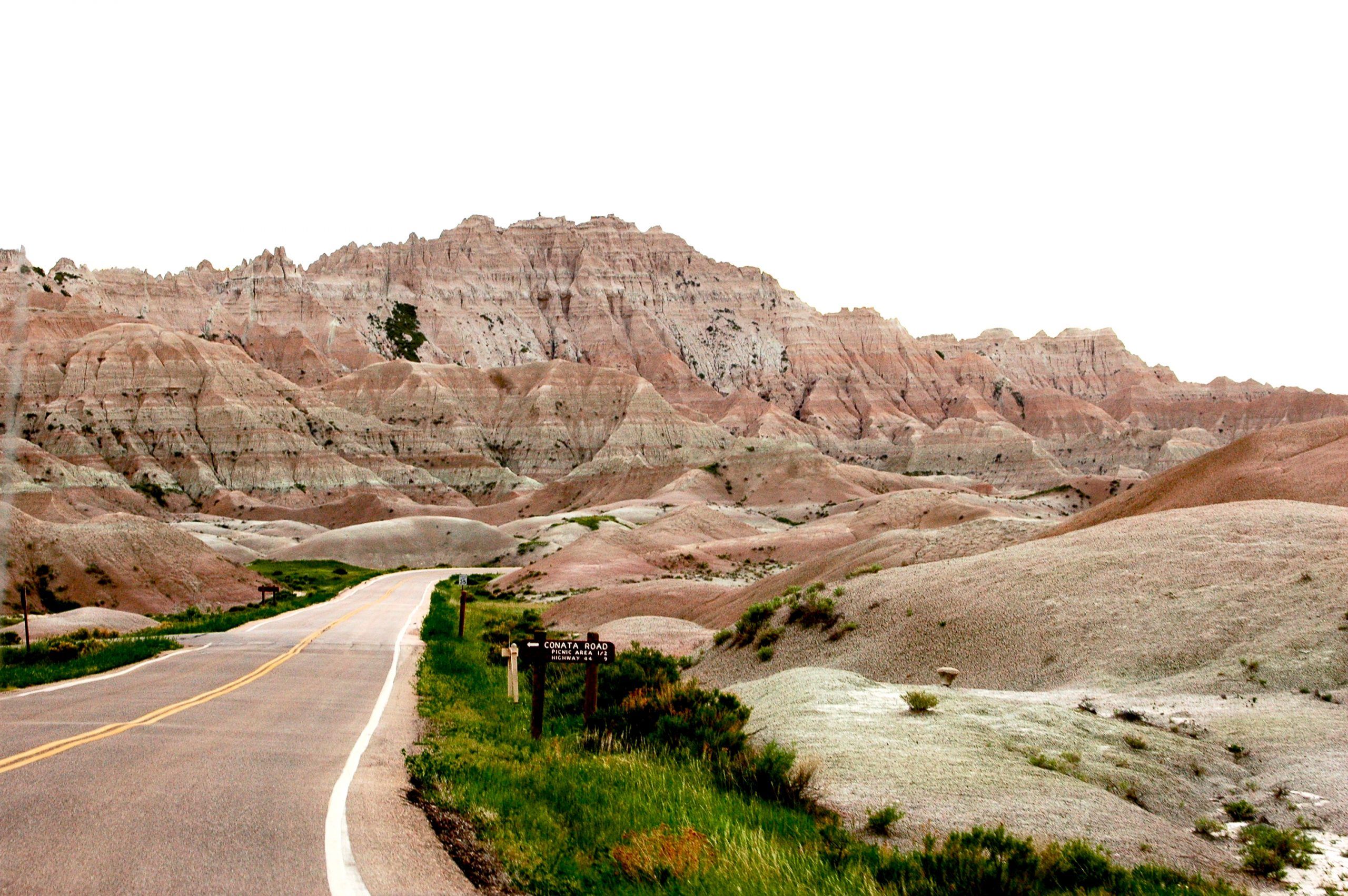
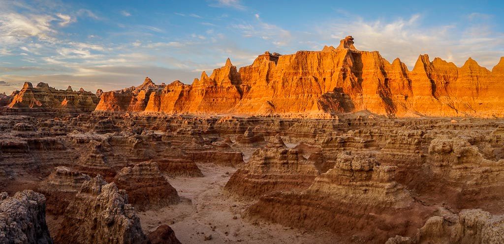
If one day you will be passing through South Dakota and looking for a spot to enjoy some great hikes, even if it’s for a day or two, Badlands National Park is a must. It has very little visitors because of its remote location and it contains beautiful contrasting views between the Great Plains and the Badlands. It has fossils of prehistoric animals, legends, geological formations, and solitude so intense that few can handle it.
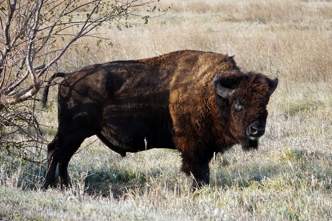
There is plenty of wildlife in the Badlands National Park. From coyotes, mountain goats, to prairie dogs, bison and many more.
It’s located 1 hour and 30 minutes away from Mount Rushmore. Anyone who is visiting Mount Rushmore shouldn’t miss out on this openly hidden secret.
Table of Contents
General Information About The Badlands National Park
- Open 24 hours 7 days a week
- The National Park has 2 visitor centers Ben Reifel Visitor Center and White River Visitor Center
- Ben Reifel Visitor Center is open all year long.
- White River Visitor Center is open during summer
- For private vehicles, the entrance fee is $30 (covers entry of private vehicle + occupants for 7 days)
- For individual hikers, the entrance fee is $15 (covers entry for 7 days)
- For motorcycles, the entrance fee is $25 (covers entry of motorcycle + occupants for 7 days)
- You can also buy an annual pass for $55 if you think that you will be returning again to the national park within a year
- GPS location of the park 43.748110671963, -101.945786522360
- Badlands’ climate is extreme. If you come in the summer be prepared for temperatures up to 110F with no shade on the trails
- There is only one restaurant in the park. Consider that before packing your food
- Two main campgrounds of the park are Cedar Pass and Sage Creek.
- Cedar Pass campground is open year-round, with some limits in the winter months. Reservations can be done online or via phone. Campground is paid but has more amenities.
- Sage Creek is open throughout the year, no reservations are available and is free of charge (however, no water is available).
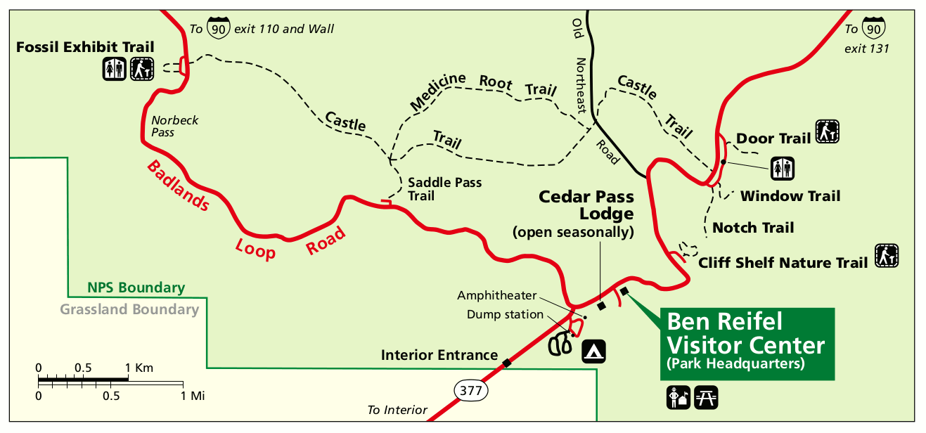
Getting In / Getting Out
You can only get to the park by car.
I-90 road provides easy access to the Badlands loop road, the main road through the park.
Enjoy this scenic drive, it’s as beautiful as the walk in the park.
The drive leads you through a mixed landscape of grasslands and the Badlands. Along the way, there are multiple pullouts to stop and enjoy the Badlands wilderness.
While driving keep your eyes open for potential sightings of a lone bison, a dear or a bighorn sheep.
 For those that will be using GPS to get in, here are the coordinates – Latitude: 43.748110671963 – Longitude: -101.945786522360.
Mandatory Gear For A Hike in Badlands National Park
It’ll vary depending on the season you arrive, but the core will be the same.
- A day pack
- A hat
- Sturdy hiking shoes or trail runners with good ankle support. The trail is uneven and can be slippery if it rained.
- Food (snacks, sandwiches)
- Bring at least a gallon for a day’s hike
- Sunglasses and sunscreen
- Hiking pants and long hiking shirt to avoid getting sunburnt
- Optional warm fleece if you arrive early in the morning or/and leave late in the night
- Optional rain gear if you plan to explore the park for more than a day
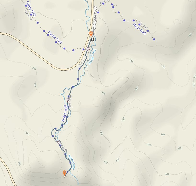
The must-do hiking trails in Badlands National Park
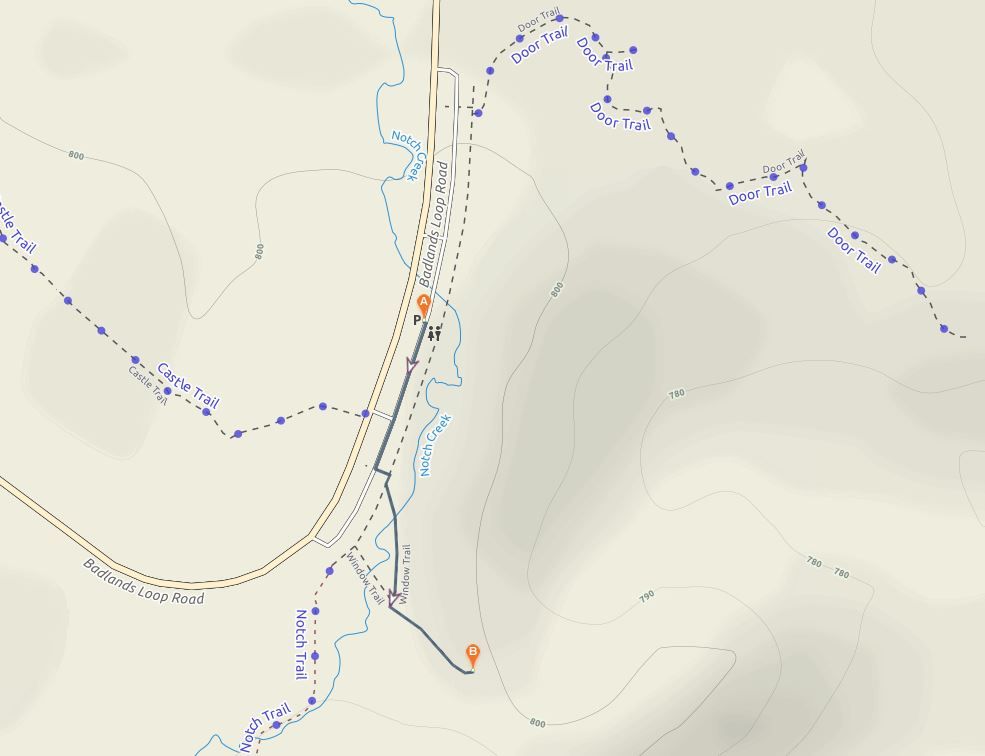
Notch Trail
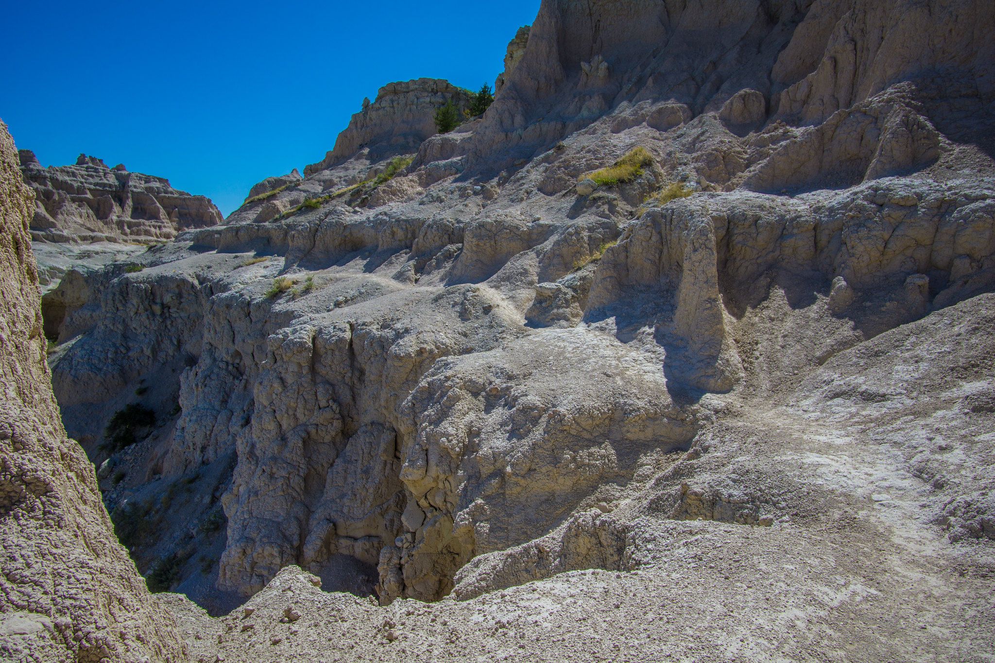
It’s a short 1.33-mile round trip hike with spectacular views. For those who have a fear of heights, it’s best to skip this one as you need to scale up a steep ledge on this hike. Otherwise, an enjoyable and slightly dangerous hike awaits you. The trailhead is at the south end of the Door and Window trail parking area. The fun will start when you reach a 50-foot ladder leading to the top of the rock.
From there, a short trail follows the ledge, passing right beside the cliff and will lead you to an abrupt cliff edge at the top of the hill which looks like a Notch. This is where it got its name and offers one of the best views of the White River Valley.
Trail Data
- Difficulty: moderate to strenuous if you are not used to hiking.
- Length: 1.33 mile
- Trail starts: south end of the Door and Window trail parking area.
- The exact coordinates are 43.76012, -101.92825
- Key Tip: be careful when hiking after it rained, it’s extremely slippery.
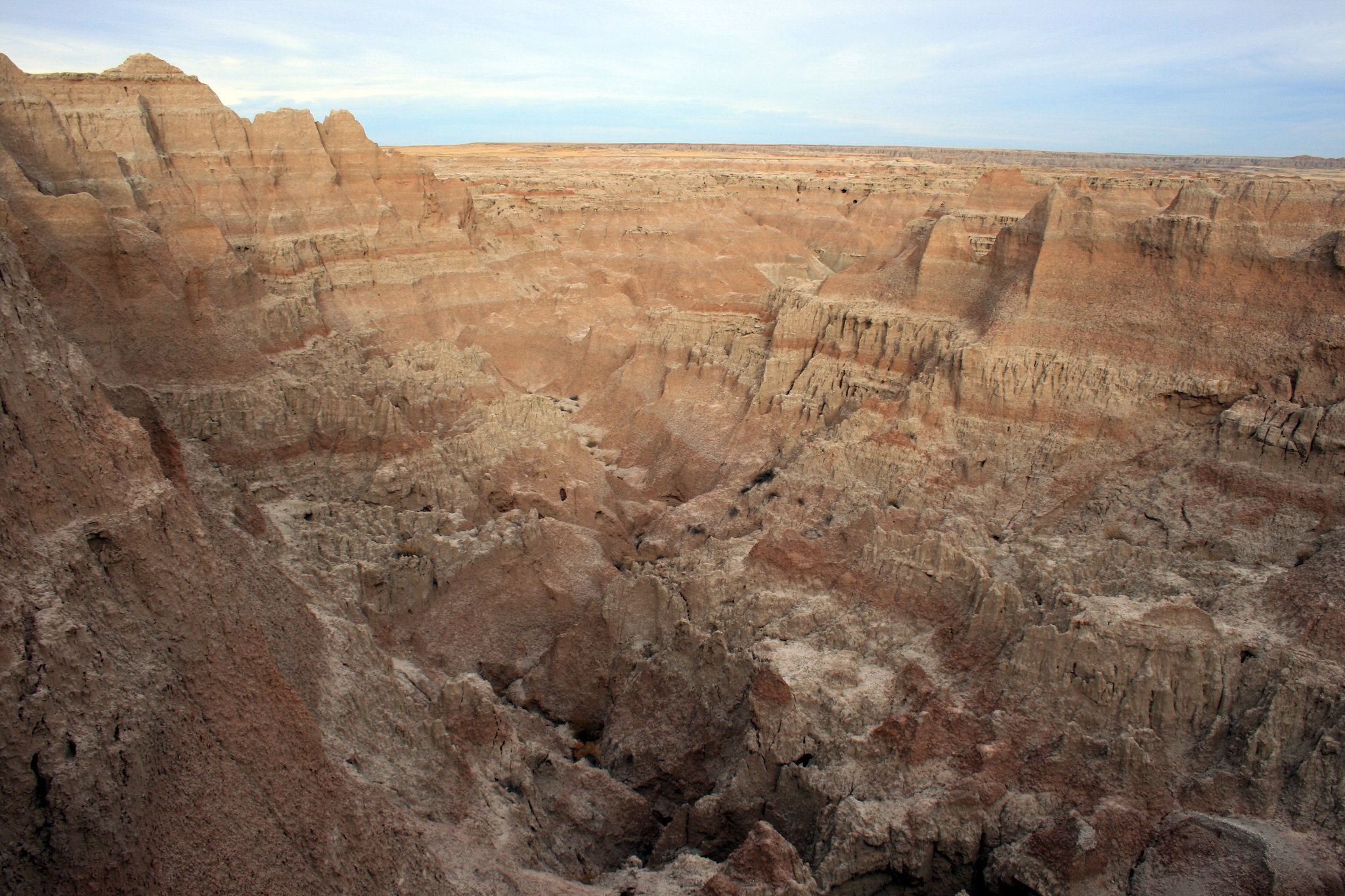
Door Trail
This is a short 1-mile round trip trail that takes you to the heart of the Badlands. If you have ever wondered why this place is called Badlands, you will understand after hiking this trail. The culmination of the hike is the view of the steep eroded canyons and rock formations where life seems impossible.
The trailhead is at the Door and Window parking area and is on boardwalk that leads you to a break in the wall known as the “Door”.
Trail Data
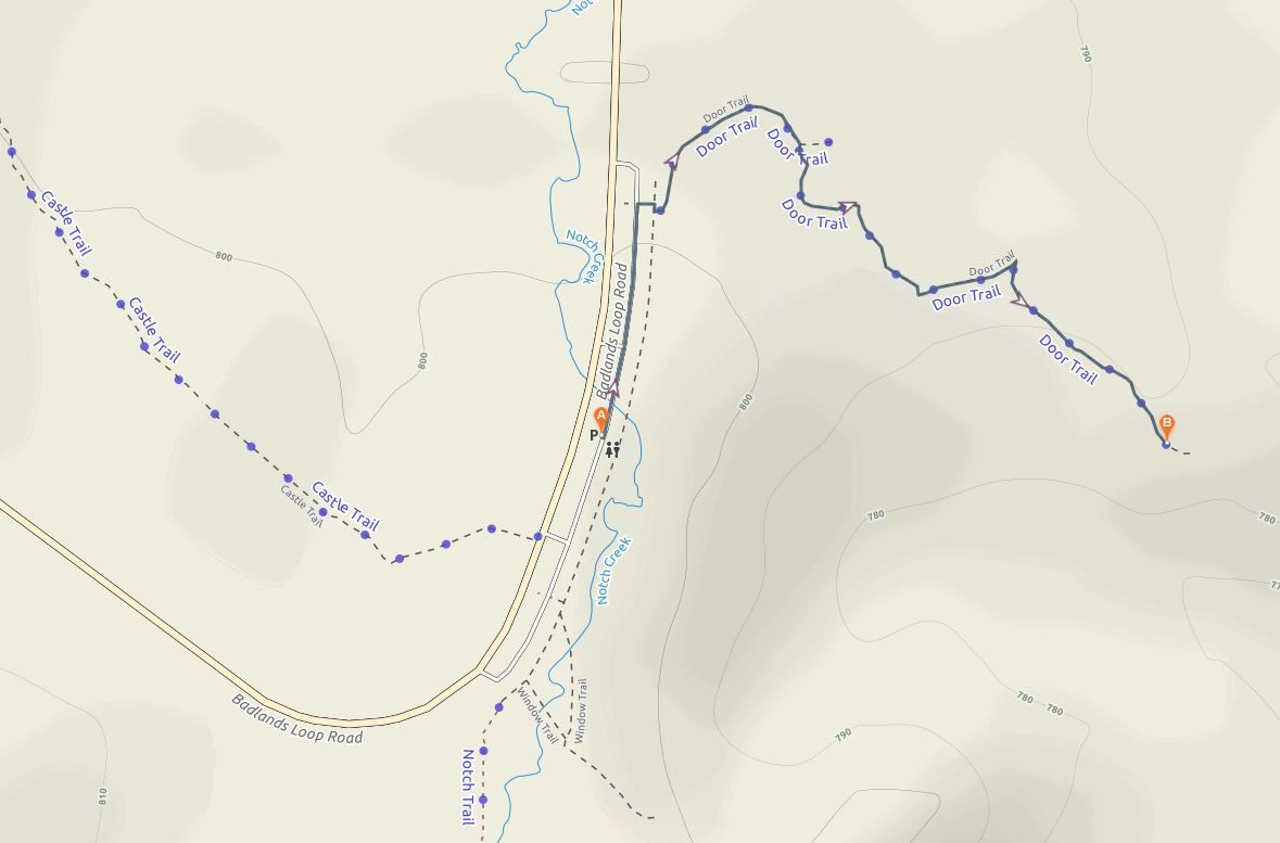
- Difficulty: easy
- Length: 1 mile
- Trail starts: north end of the Window, Door, and Notch trail parking area.
- The exact coordinates are 43.763578, -101.927095
- Markings: marked by yellow knee-high posts.
Window Trail
The shortest and the most trafficked trail in the park at only 0.2-mile length. It’s similar to the Door Trail in that it is on a boardwalk trail leading to a large opening in a wall, except that you can’t pass through like at the Door. If you have little time, this is the best way to experience true Badlands. However, it’s particularly beautiful at sunset time, if you can time your visit for golden hour, you will appreciate the incredible geologic rock formations even more.
Trail Data
- Difficulty: super easy.
- Length: 0.2 mile
- Trail starts: south end of the parking lot just above Notch trail.
- The exact coordinates are 43.760634, -101.927624
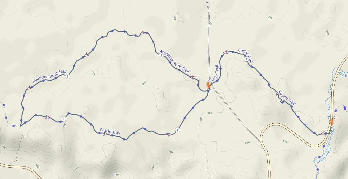
Castle Trail
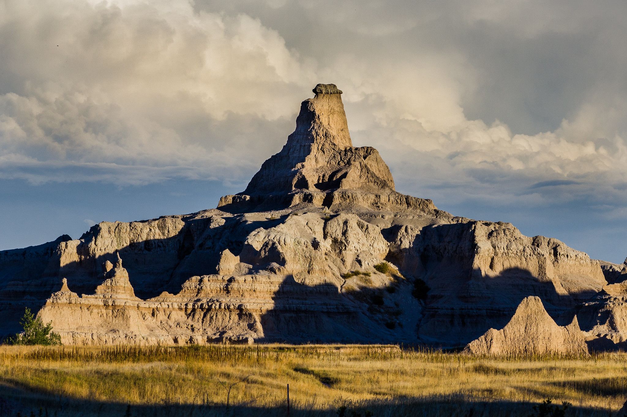
The longest and probably the most spectacular trail in Badlands National Park stretches the whole 5.5 miles. Being in a more backcountry area and a bit less trafficked trail, there is a greater chance to encounter some wildlife along the way. You might have the opportunity of spotting, bison, mountain bighorn sheep, skunks, and prairie rattlesnakes.
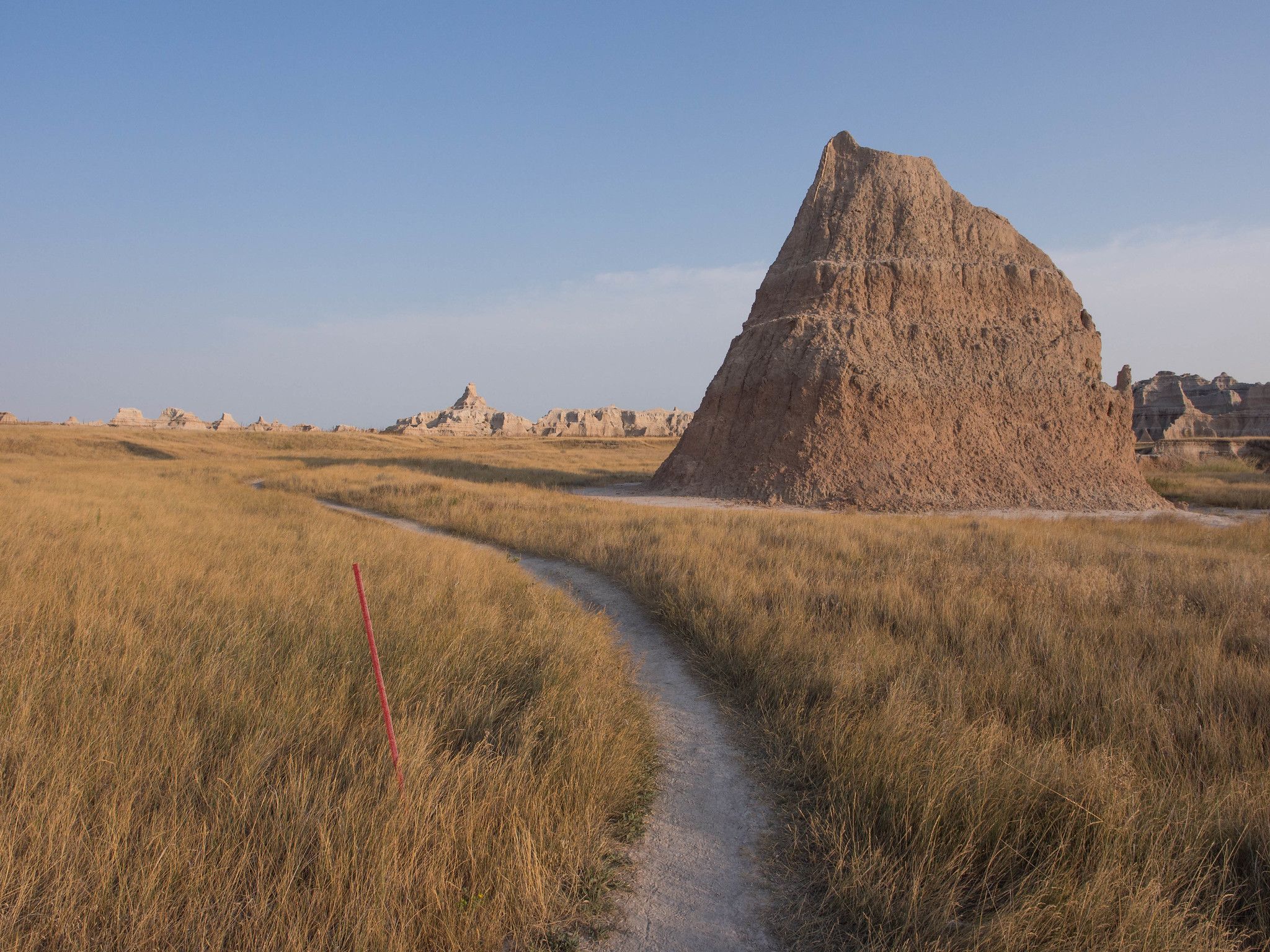
Despite its length, this trail is not overly hard so don’t let the distance put you off doing it. The trail crosses open prairie into rugged gullies, weaves through a maze of spires, buttes, sod tables, and fins, all masterfully blended with the open prairie. There are many viewpoints to enjoy of the Badlands Wall and of the White River Valley.
At the end of the trail, before turning back, cross The Badlands Loop Road and explore a short 0.4-mile Fossil Exhibit Loop Trail. On the way back, you can hike the Medicine Root Trail to avoid repeating the same route.
Trail Data
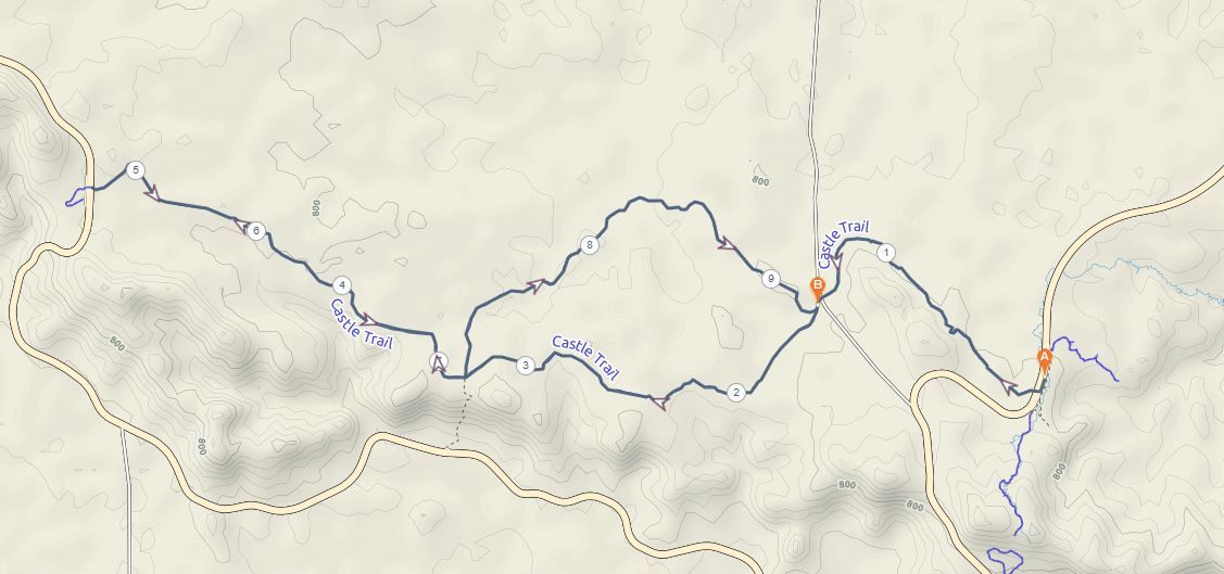
- Difficulty: easy +
- Length: 5.5 miles one way or 11 miles back and forth
- Trail starts: starts at the north end of the parking lot. On the other side of the road going towards Notch trail.
- The exact coordinates are 43.7613, -101.92792
- Tip: be careful of rattlesnakes.
Medicine Root Trail
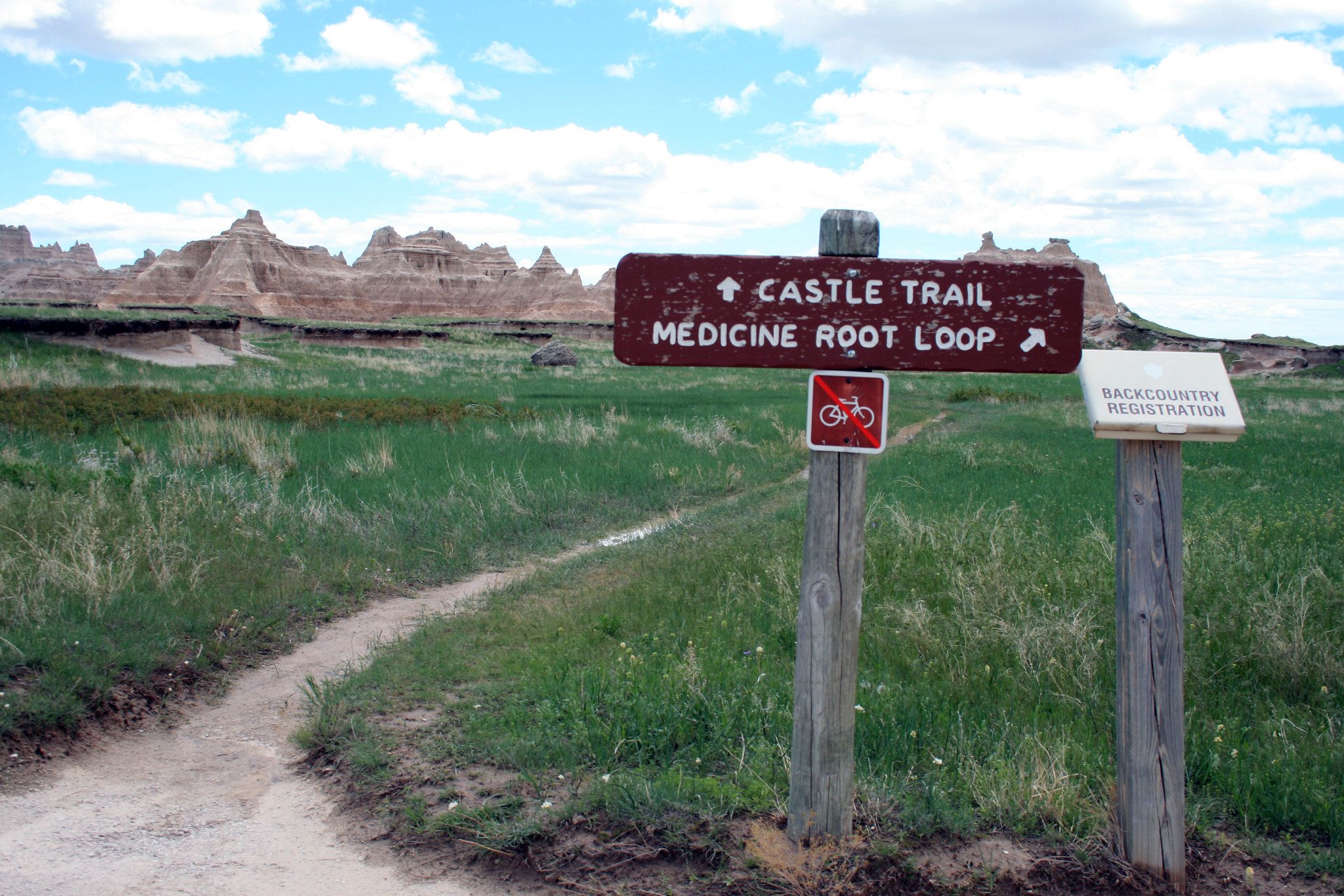
This is an easy hike with views in the distance of the Badlands and chances to sight bisons, skunks, prairie dogs, bighorn sheeps, and other wildlife on the way. It’s also well-known for beautiful wildflowers and cacti growing around the trail.
The 4-mile Medicine Root Loop trail traces gentle rolling hills and intersects with Saddle Pass Trail and Castle Trail at one point, if you want to make it an extended hike.
Trail Data
- Difficulty: easy
- Length: 4 miles
- Trail starts: at the north end of the parking lot. On the other side of the road going towards Notch trail.
- The exact coordinates are 43.7613, -101.92792
- Tip: watch out for cactus and rattlesnakes
Fossil Exhibit Trail

This is a very short 0.4 mile-long loop trail. Do not expect dinosaur fossils here though, as it’s more of a visitor center kinda hike. It’s on a boardwalk (but you are allowed to walk off the boardwalk) with boards explaining the type of fossils found in the area. It’s a great hike to get to know the region and history about the place and is one of the most accessible trails in the park.
It can be included with the Castle Trail, for a nice longer hike, or keep it short for the whole family to enjoy.
Trail Data
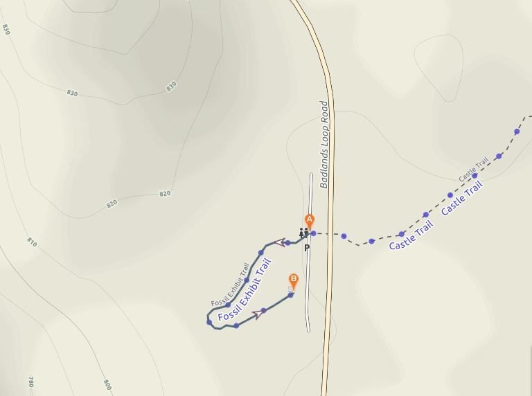
- Difficulty: very easy
- Length: 0.4 miles
- Trail starts: at the end of a Castle trail, the Fossil Exhibit trail parking.
- The exact coordinates are 43.772744, -102.002699
Conclusion
Badlands National Park’s breathtaking views, rich geological history, diversity of species, and easy trails make it the ideal place to explore for any hiking and backpacking beginners.
Please share your experience if you visited the park or it’s in your future plans in the comments below!
I have never heard about Badlands National park in USA but the rocky structures looks quite gorgeous. Apart from it glad to know about the dinosaur fossil history which is kept inside the park. You have described in detailed about the trails ; my favorite are Door trail and window trails. These are just breathtakingly beautiful.
Wow, what a cool place! That landscape looks like it’s from another world. I love how diverse the nature in the US is and how easy it is to spot wildlife in the National Parks. I would love to visit Badlands one day. The door trail and castle trail both sound like a lot of fun.
Thanks for sharing this another walking trail tour. The Badlands National Park is incredibly beautiful. This place is a good sight for landscape photographers too.
Not good but perfect spot.
I would love to hike around badlands with my camera. The landscape of this location is really amazing.
Looks like a great national park! The landscape is beautiful and I like that there are short and long trails to choose from. I would definitely avoid during summer though, 110F is blazing hot for hiking.
Oh wow.. These are some stunning trails, and hiking these would be so full of adrenaline and adventure, yet soothing at the same time. Going by the photos, I am really hooked on to the Door Trail. That picture looks spectacular. Great share..
I can’t wait for the National Parks to open up again to the public! I have neglected exploring much of my home country and after hearing of friends awesome adventures through the natural beauty, I am on a mission to check them all off my list. Badlands looks like it will be high up on the list for me, thanks!
Glad to hear! Love the Badlands National Park.